Over at The Trek.
Week 1 just went up here: Pennine Way week 1
While I am walking I do not want to manage cross copying content in two places.
Over at The Trek.
Week 1 just went up here: Pennine Way week 1
While I am walking I do not want to manage cross copying content in two places.
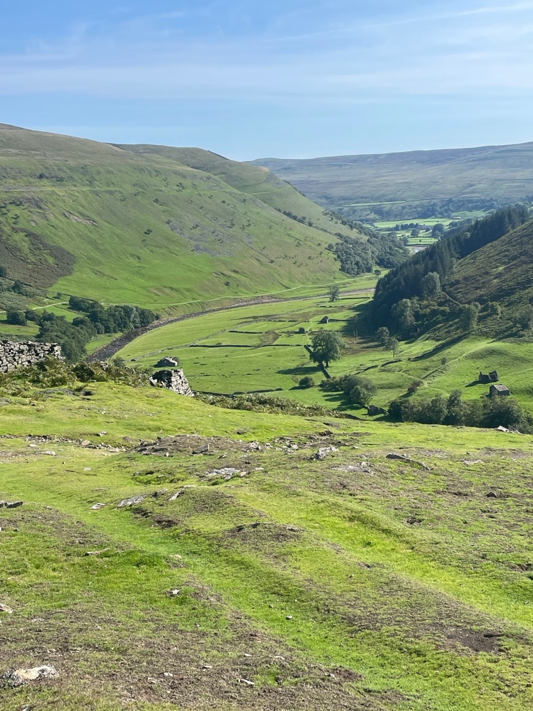
Here we go, here we go again, yet another trip to the UK for some distance backpacking. To be honest I just really love the walking vibe in the UK. In the US taking your doggos on long trails adds some serious logistical nightmares, especially since most State and National Parks have a ban on dogs pretty much anywhere outside of “paved” areas. The UK however, there are dogs everywhere, and I just find the walking vibe pretty chill over all. I was already heading to Scotland for the TGO (The Great Outdoors) Challenge. and the wife gave me a pass for a second month so I decided to add the Pennine Way on the front end for the month of April. What is nice about the Pennine Way is there are quite a few Summits on the Air peaks, and I have also added a variation to include the Yorkshire Dales Three Peaks Challenge for an additional two SOTA peaks.

What drew me to the PW first was I wanted to make sure I was in walking shape for the TGO, and I am essentially walking to Scotland along “the spine of England”. During our Coast to Coast last year we crossed paths with the PW near Keld. Since I missed out on some travel last year for some personal things and after my success of doing SOTA + Thru-hiking on the WHW, I wanted to step it up one more level with a trip that was >200 miles. The PW offers that, and M1EYP did a similar style trip back in 2013, plus my 3 peaks challenge variation gives me plenty of distance to get strong. I am allowing 20 days total on the PW and looking to mostly wild camp it, however I do have a couple of nicer stays which will also be resupplies. Also when in a town named “Once Brewed” and a pub named “Twice Brewed” you have to pay the extra just to check it out. Of course I will be finishing with the Border Hotel before moving on.
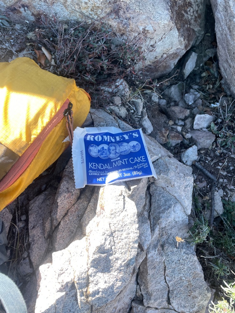
After the Pennine Way, I have about 15 days before I need to be in Glen Shiel for the start of my TGO Crossing. I’ll probably get up there a little early as the 5 sisters of Kintail looks pretty enticing from a hiking (and Summits on the Air) perspective. The Lakes are calling my name as usual so I may roll that way some too! Kendal here I come for some Mint Cake!!
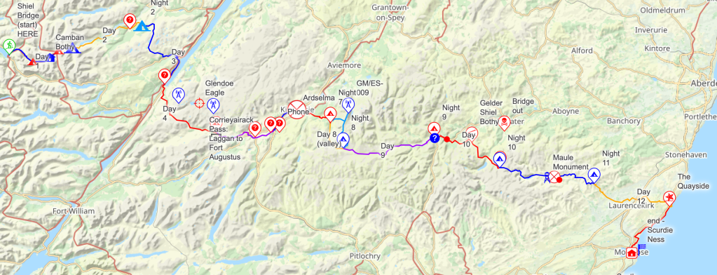
The TGO Crossing starts somewhere in the second week of May and finishes two weeks later. I only have 3 days to get from WAY up North back to London. Lets go, fingers crossed for no train strikes!!
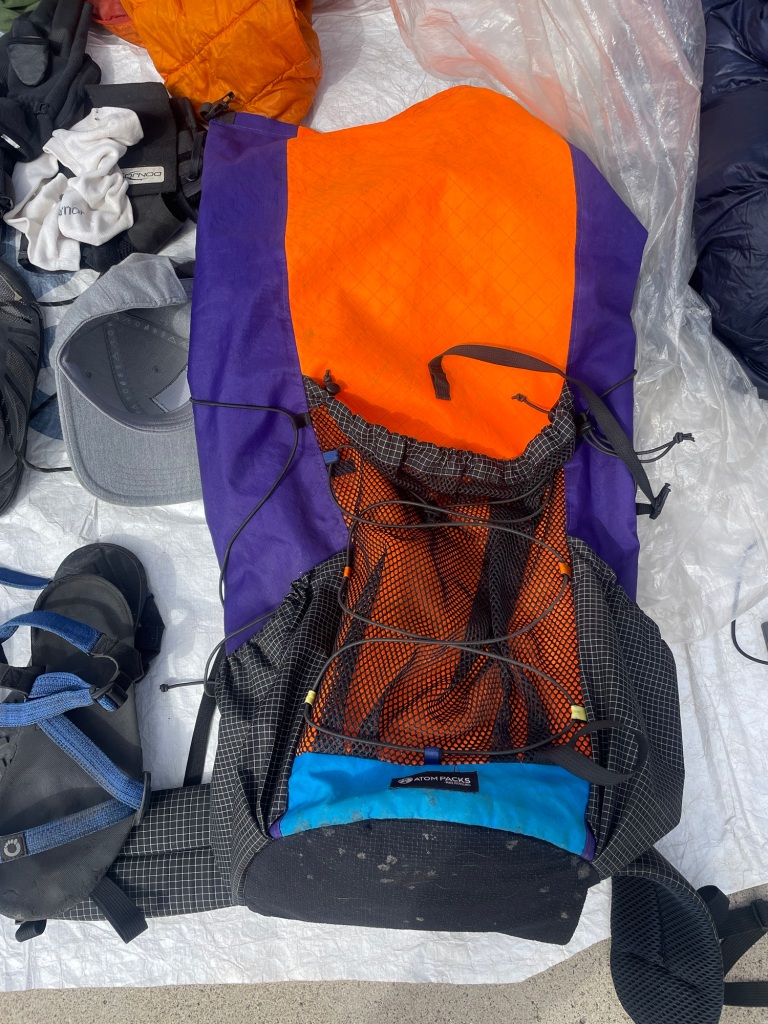
So now for the nitty gritty, this whole trip like is one big backpacking trip (albeit a posh one), and I will do everything with a single backpack. Note: Trekking Poles, tent stakes and a few other things will have to go under the plane, and I’ve got a few ideas for that.
So what does the gear load out look like for this trip (and keep in mind I am not a weight nerd. Plus I am comfortable with 20 mile days at 40lbs, so I am shooting for 35lbs just to be safe. Although keep in mind, food tends to be what pushes most pack weights into the ‘uuugggghhh’ realm, and with this being the UK there are chippies, kebab shops and cafes everywhere so I’ll probably only ever have 2-3 days of food on me at any given time. I will have to up that to 4 days though once I start the TGO.
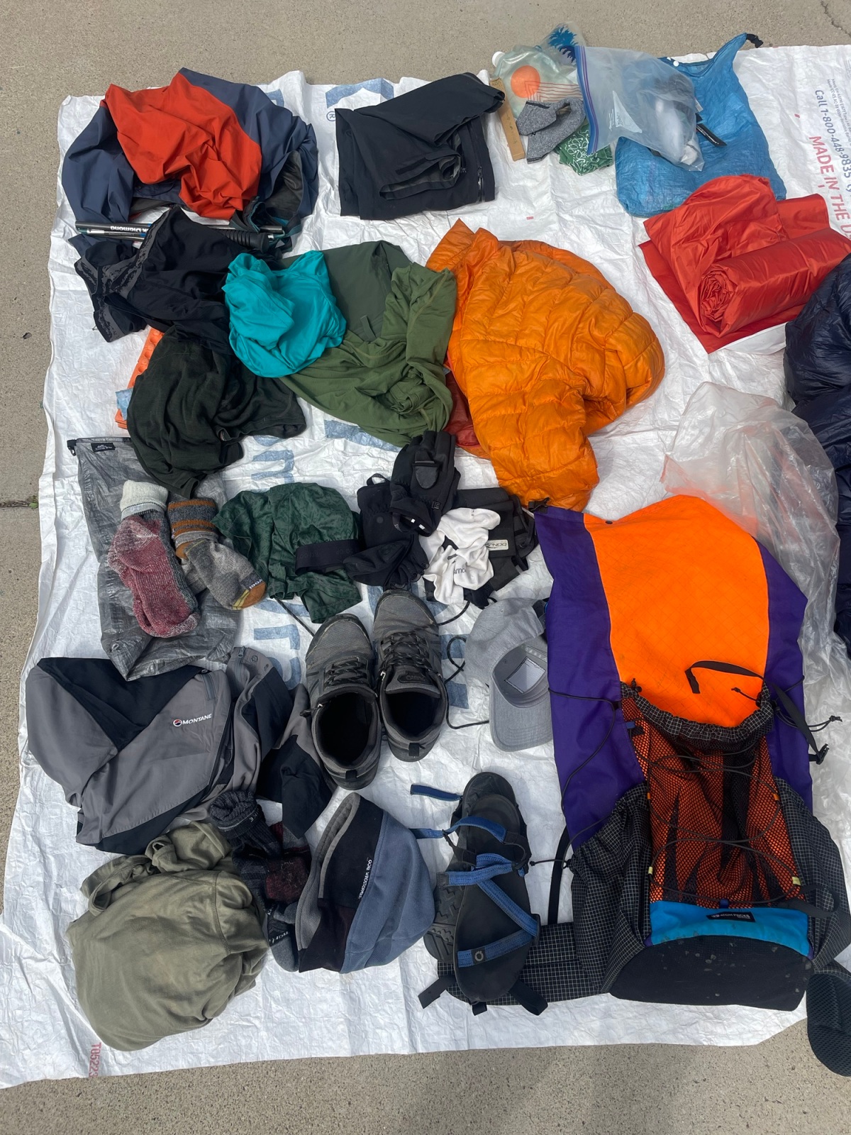
So what gear am I taking for 2 months on the road/trail/travel? (note other than the Drink LMNT link, all other links are not affiliates and go direct to the manufacturer were possible. I am not getting paid/sponsored/asked just including the links because it is gear I believe in). The list is kind of long, and I will skip the little odds and ends and stick the macro items. AS of the time of this writing and for the things going with me, the pack weight is at 24 lbs. Once I add in food (mostly breakfast since I am wild camping most of the walk) I’ll be closer to 30lbs
I’ve embedded my walk through video at the bottom if you do not want to read it all, it’s about eight minutes long.
Clothing:
Other Odds and Ends:
I wanted to take advantage of being in the area, so after scouring over sotl.as, finding a peak that met some of my requirements, studying the (digital) topo map and finding very little info for the approach, I went with a peak that seemed well within my wheelhouse. Plus, it has a cute name to boot, “Nutt Benchmark”. It was also a First Activation peak, so those are always fun (and typically involve the most planning and do tend to give me a little anxiety.
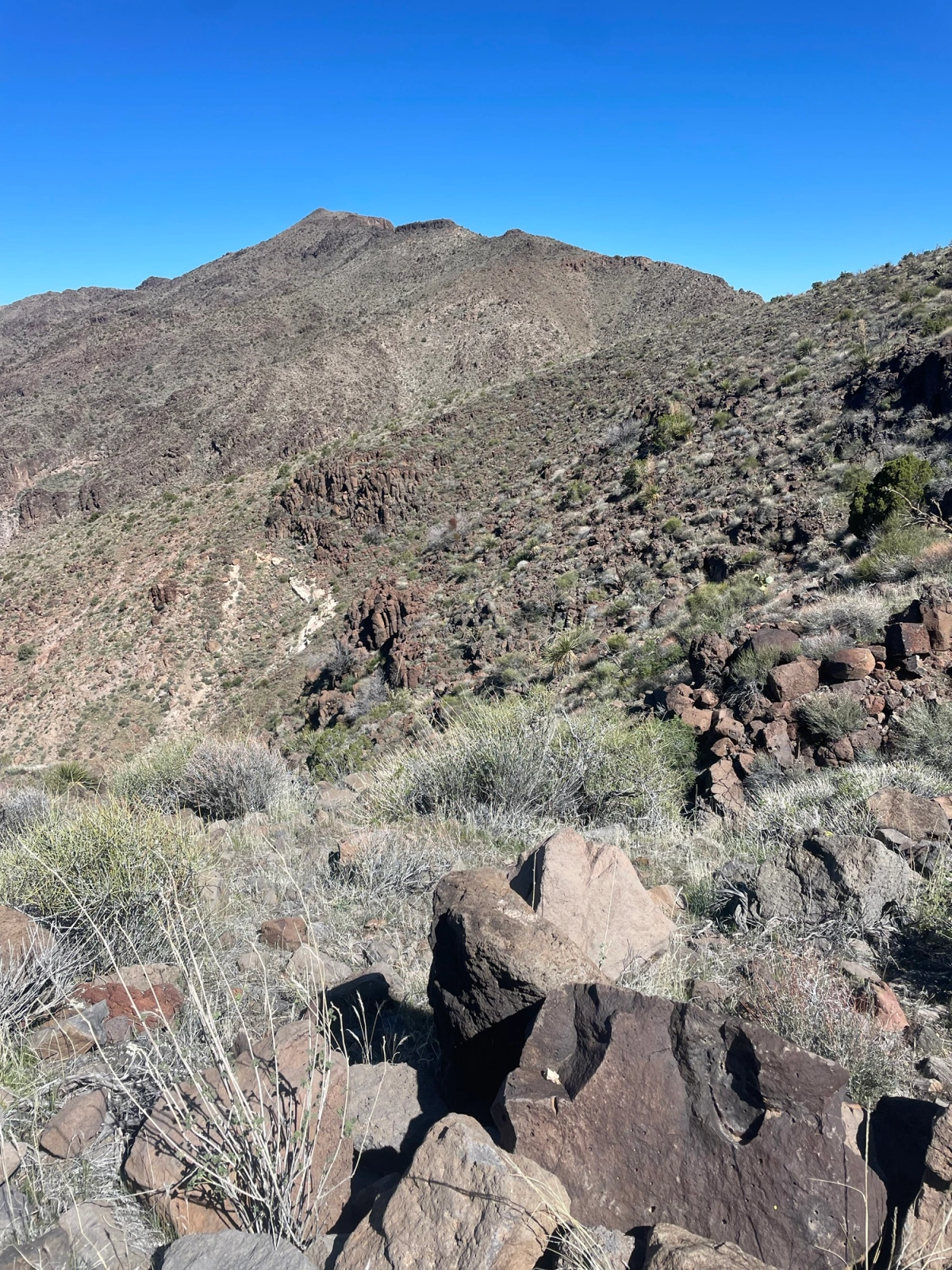
At the Sitgreaves Pass View point is a wonderful (and big) with some flat spots pull out that we ended up using as a post up. That was the one useful tip the couple of trip reports I found contained. So with some daylight left, and me wanting to do a little exploring I managed to climb my way to the top of the nearby ridge line. It turns out that there was a well cairn’d use trail that wandered off in the direction I wanted to head the next day. After walking out about a mile and confirming this approach trail would work, I opted to shift from the route I was going to use to staying up along the ridge line to a specific saddle. From the saddle to the summit is about a mile.

So with that I was off from the pass at around 8:30 in the AM. I would say the ascent from the parking lot to the ridge line, and then a few segments along the final push are kind of the cruxes along the hike. Well, that and the various cactus (some of which were in bloom on this walk). If you have ever been to Oatman down the hill you have probably encountered the very docile and tame donkeys. However out here in the uplands those donkeys are a bit more feral. As soon as I crossed into the hills and they were aware of my presence, they were gone. The walk is in a N by NE direction until a saddle is reached with great views over towards the Hualapai Mountains. From here turn towards Northwest and knock out the last 800 feet of elevation gain in about a mile.
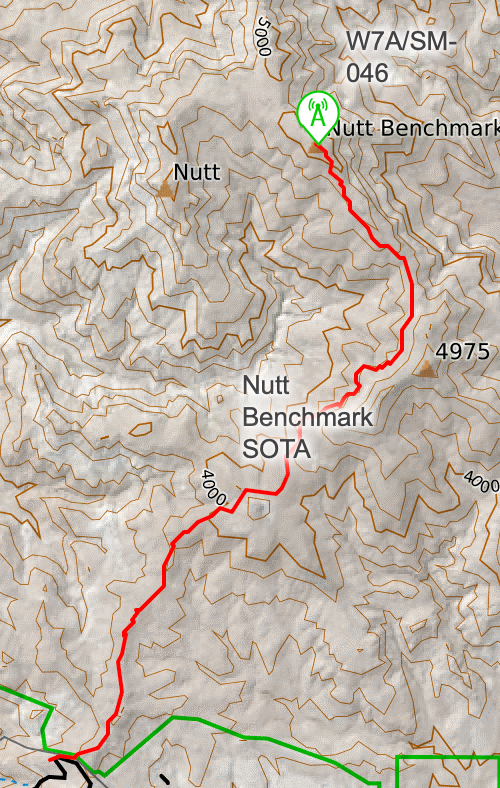
Because the elevation gain is pretty minimal I made pretty good time scooching along the approach ridge. You actually pass right under another SOTA summit (4975, W7A/SM-055) that would make for a fun two-fer. For what I could tell the approach up 4975 would be pretty easy, but it does look steep. I was considering the two-fer and would allow the build up of clouds determine yes or no. Once the saddle is reached the trail (for the most part) is over, there are plenty of braided paths to the summit, however one thing I would advise is to not push for the final ridge until after that last rock wall you encounter. After that though it’s smooth sailing.
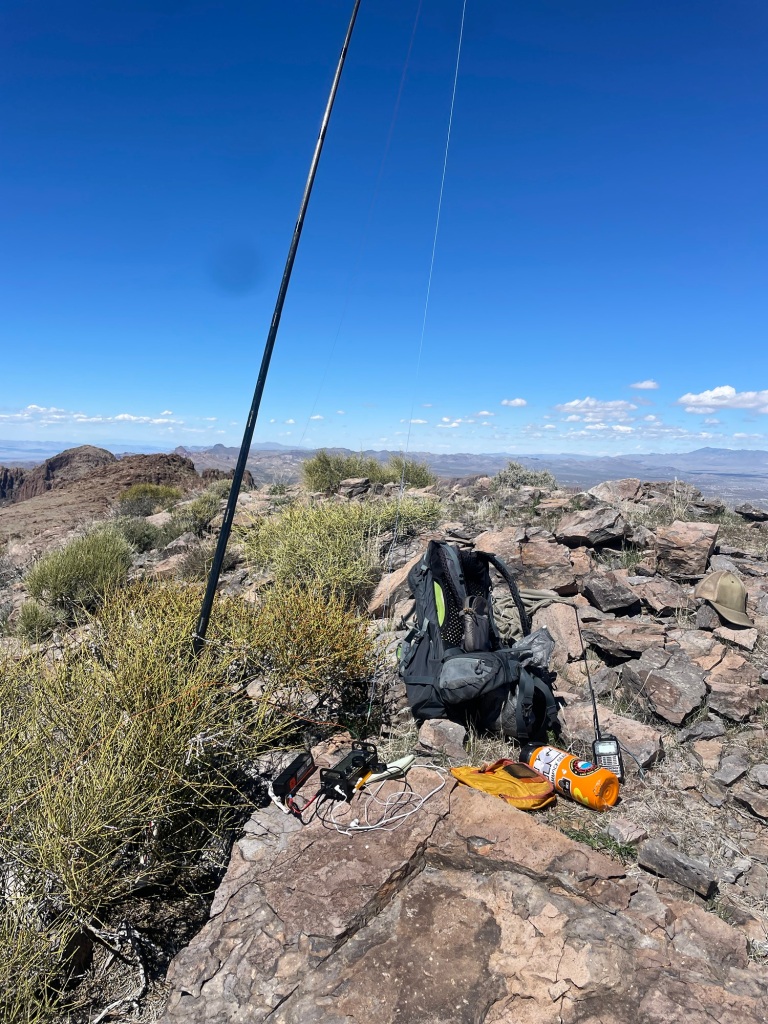
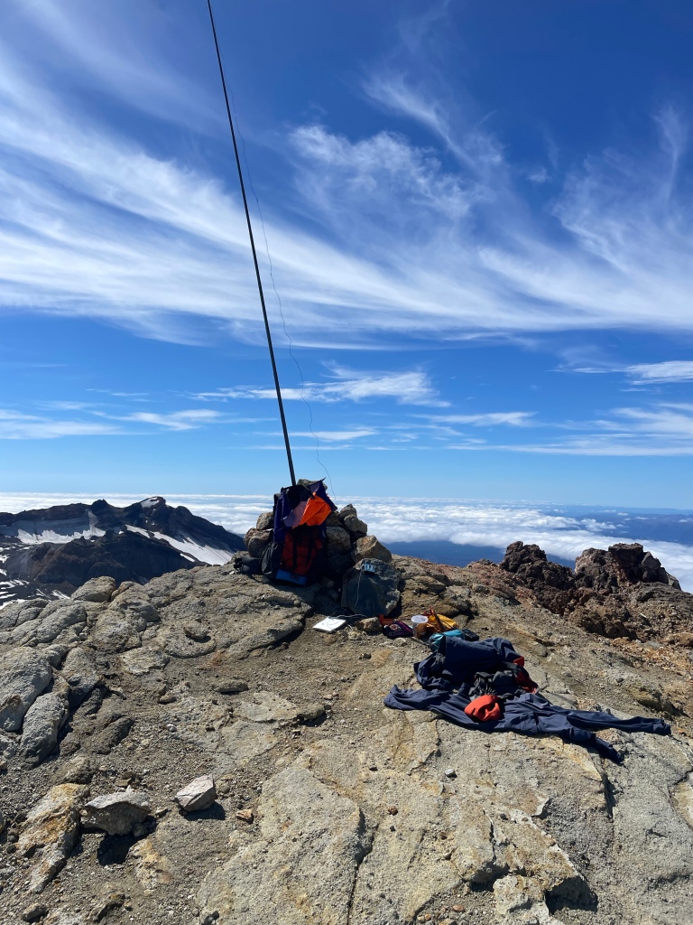
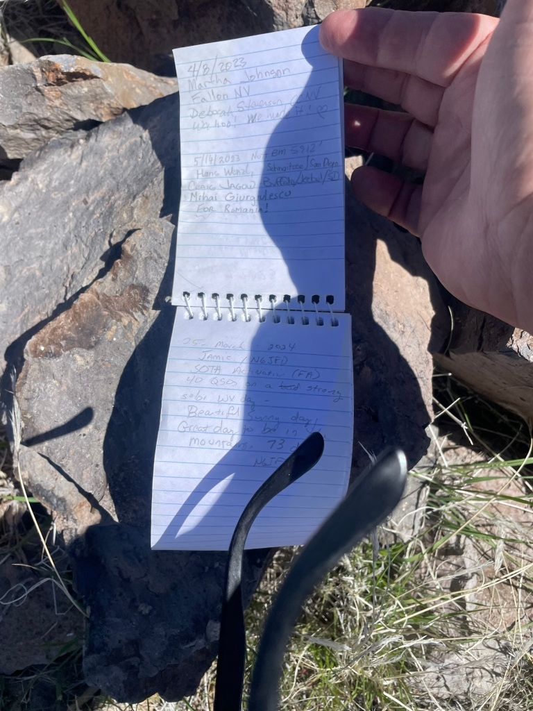
The summit area is a large flat area so plenty of room to spread out and enjoy yourself. Since this is not that popular of a peak (for some reason), it’s not like you have to keep your station setup small. When I say this peak is not that popular, the last person to sign the log that was on the summit was in May of 2023, ten months ago. The log based upon the the business card inside the PB Jar (yah do not use PB jars, those plastic lids deteriorate quick) was placed by the Las Vegas Mountaineering club. No idea if they plan outings or what.
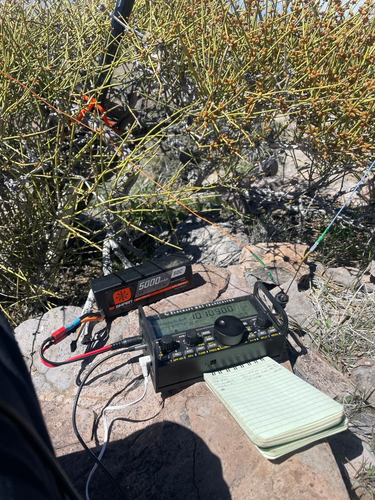
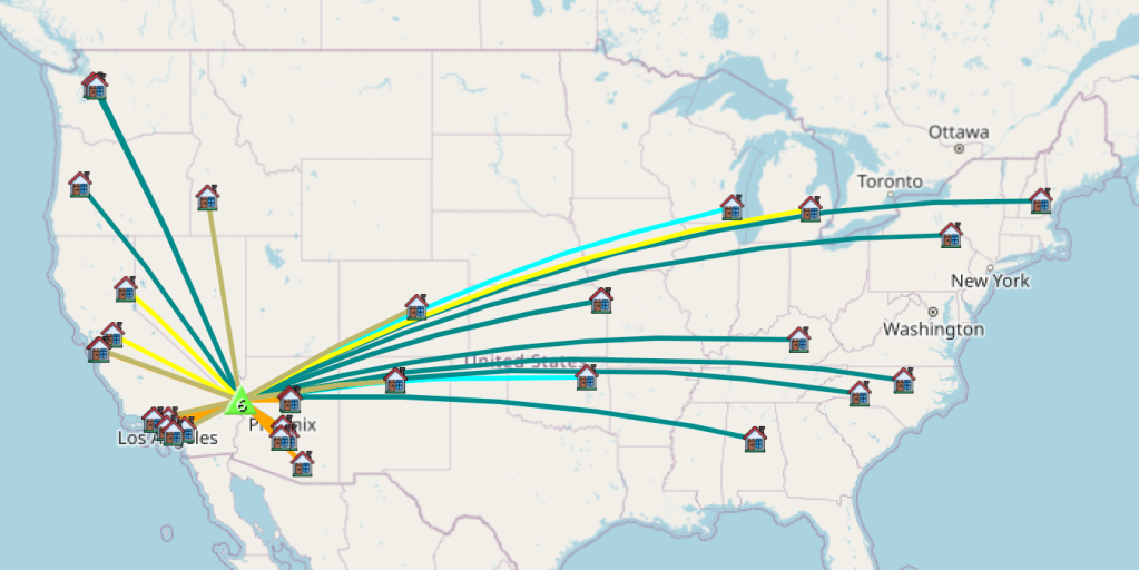
I spent about two hours on the summit on a day following a pretty large solar storm, so the fact that I managed 40 contacts across five bands was pretty impressive. No DX to be had, and as much as that probably had to do with my late start, i am guessing the dead bands also were a part of it. SFI of 195, and K of 4 are not optimal conditions, but as I noted, I made it work.
Part way through the activation I was noticing the same afternoon build up of clouds and virga that we kept getting during the softball tournament, so I opted to stick around a bit longer and keep activating, but would skip the second peak. The walk down was pretty uneventful except that I did step on a chunk of cactus, and it went through the bottom of my shoe (ouch), so that took a few minutes to dig out.. That and for whatever reason I kept losing the trail on the return even after I was on the main path. So pay attention. Overall I would put this as a medium effort peak, I covered a total of 10.25 miles and just shy of 2200 feet of total ascent.
Some final parting shots:


73 de N6JFD/P
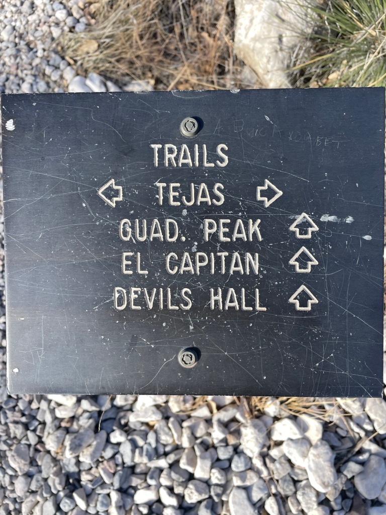
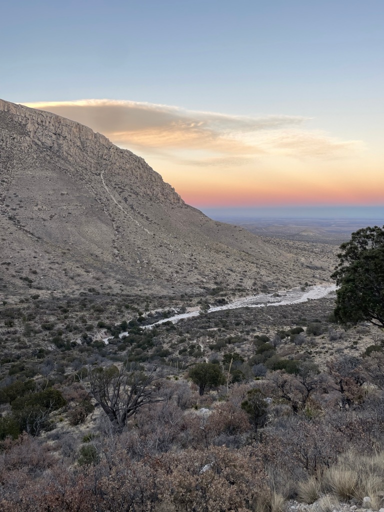
Two days in Guadalupe Mountains National Park for a day of hiking the Texas State High Point
In the quest for state high points and available time for getting up to the PNW we spent two nights at Guadalupe National Park. The Guadalupe Mountains are a North/South running chain in the West of Texas and South East of New Mexico. This area is also close to Carlsbad Caverns which if you have the time is worth a stop over as well. This mountain range at one point was a reef bed and many of the fossils date back to some 40M years ago during the Permian Age1.
There are two main campgrounds, plus a horse corral. The Pine Springs Campground is at the base of the hike for Guadalupe peak which was my goal on this outing. The Pine Springs CG uses part of the parking lot for 13 “RV” sites, and there is a separate loop in the same area for tent campers to make for an easy leisurely start to get up Texas’ state high point. This area is really close to the Central/Mountain Time Zone line, so at times your phone will present with one or the other. Hopefully while you are there time is not that important because it’s hard to know what time it really is :D. My Garmin once I started my GPS track was using MST even though my phone was still showing CST.
The steepest part of this trail, and the part that is going to make or break you is the first two miles. Lots of steps made by people with long legs and a short torso, so for those of us who are say…average height (or shorter) and are a 50/50 torso/leg split do have a bit of extra work. The other option is follow the others up the side of the rock steps creating new erosion channels (see principle 2 of LNT for why you should not do this). I wanted an early start because as usual the goal was Summits on the Air, and hopefully some EU/UK DX. I was moving pretty early on and greeted by the park volunteers at the bottom of the trail with the usual questions of “enough snacks, enough water, layers?” etc. Today’s weather was calling for high winds and temps in the 40-50s, towards the top there was also some snow, ice and mud on the trail. Also this is a pretty arid area so a good amount of water even on a day like today is necessary. An interesting combination of conditions to really have to prepare for.
Up I went making a good pace ahead of my hiking partner as I knew I would be hanging out on top, and wanted some time to setup. Normally I would not say separate from your group, but this was a pretty straight forward trail with out any real turn offs to end up in the wrong area. I made pretty good time overall for maintaining a consistent pace; the ascent is a tad more than four miles with an elevation gain of about 2900 feet. The Munter method would put this at a 3:45 minute hike, I knocked it out in 2:16. All that walking (and swings and squats) pay off :D. As far as the ascent went and I had an idea that because the trail is on the canyon side of the hills that we were getting a funnel effect. At about 1.5 miles the trail hooks hard left at a rock out cropping and this was the worst bit of the winds this day, but after about 200 yards you end up in a tunnel of Pine trees that cut the wind down for the next bit. I will note that this trail has a bunch fo exposure, which made for a fun descent (more on that later). The last mile was where the snow, mud and some ice was. I was quite surprised to see ice given the semi arid location, but some winter/wet weather had ripped through a few days before. So, be aware that winter weather is a possibility.
Setup the radio gear in a way to not be too wind effected and the wife was not far behind. She too beat the Munter Method timing by a good hour! For the SOTA stuff, I spent 2 hours activating across 5 bands all cw and managed 58 contacts. Most of the DX came on 21mhz and 28mhz was great for the whole US. DX included France, England, Spain and Switzerland.


One of the rules I hike/peak bag by is “anything you go up you have to come down” and that has served me well, as noted in the Big Bend post I almost broke that rule but today is not about me and my descent. I’d been aware of this one particular group on my ascent and while I was hanging out. As I was about 200 yards down I found a party who had one individual near tears and almost frozen in their tracks. This group had left about 30 minutes before me from the summit and this was as far as they got. I called out a bit ago that there was a fair bit of exposure to this walk, you are above treeline, while the summit area is pretty big the trail is exposed with long steep drop offs on the sides and this individual had reached their breaking point. They were not having it. I decided it was time to engage and pull out all those skills I’ve picked up over the years to walk the group down and overall it was a great experience. The single most important thing you can do if you do engage to help someone is listen to what they are saying.. Not just hear, but LISTEN. I had noticed that this person kept asking us to walk down in front on the harder step down. Basically they were learning what we were doing with our feet, so I made sure to wait every time we came to one of those dicey sections. Now keep in mind, I love it when a hike takes me into evening and I can catch a sunset, and I had an idea that this would happen. At one point because the cellular service is pretty dodgy I ended up having the wife monitor Simplex on the radio just in case we needed other assistance up there. Note yes there is some cellular service but it is dodgy at best, and there are parts of the trail where you go 30 minutes with no service (including no SOS), so plan accordingly. It took us about 4 hours to get down, but we all managed to get down safely. Hopefully this individual was not too turned off by the experience and their group of four does continue venturing out into the hills. I really had an enjoyable time talking and walking with the three who remained with me on the descent.
This was a great area to stop and play, and I recommend it if you are in this area, that said book early. We did end up having to move from one campsite to another in order to stay for two days. From a hiking preparedness perspective, this is a reminder too/from me to always turn around on your way up to make sure that when you look down you do not freak out. Of the people I have helped over the years both in the name of SAR and as a good samaritan, the mental hurdle is one of the hardest things to overcome when you are in that exposed out situation. We can always warm up, consume calories etc, but when we are freaking out/disregulated getting re-regulated can be the biggest hurdle to getting back on the move. Not a lot planned for March other then work our way up to the PNW and then back down to SoCal , but that said April and May will be another springtime adventure off in the UK.
After a month in Florida it was time to start westward. Big Bend seemed like a great next place to hole up for a little bit given its proximity to nothing. I was hoping to score a week in the Chisos Basin CG, but that was not happening. We ended up with M-F in Rio Grande Village, and somehow scored the weekend in Chisos. I knew I wanted to do at least one peak (Emory) since it was the park’s high point, and there is enough other stuff to do as well to fill the 8 days we were going to be here.
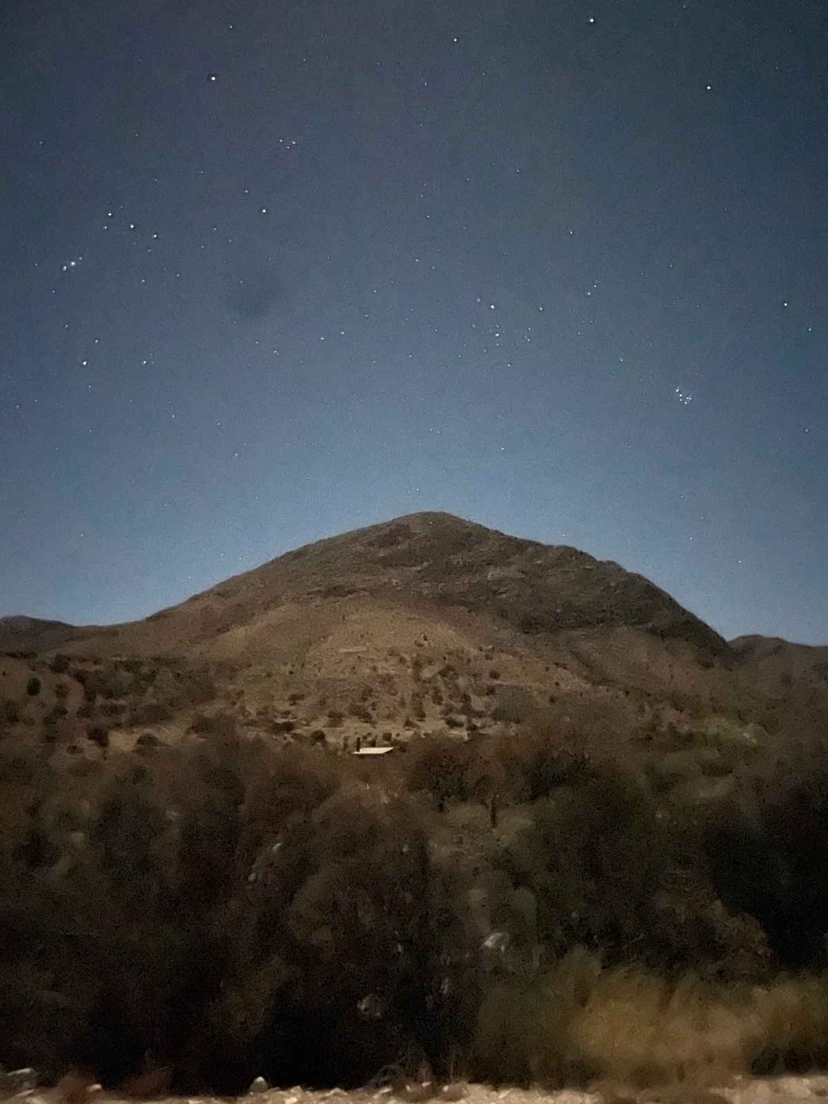
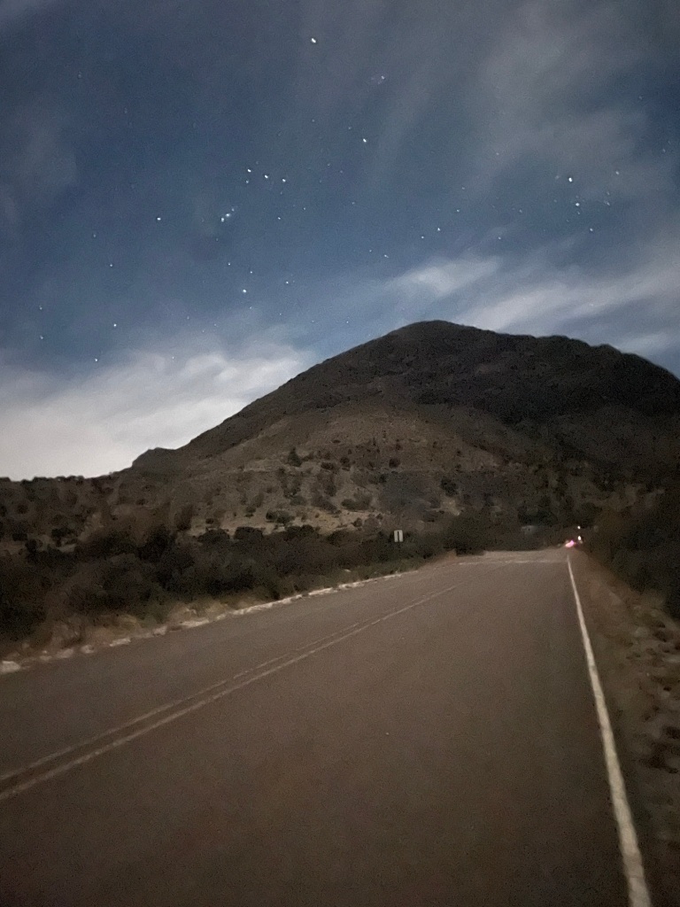
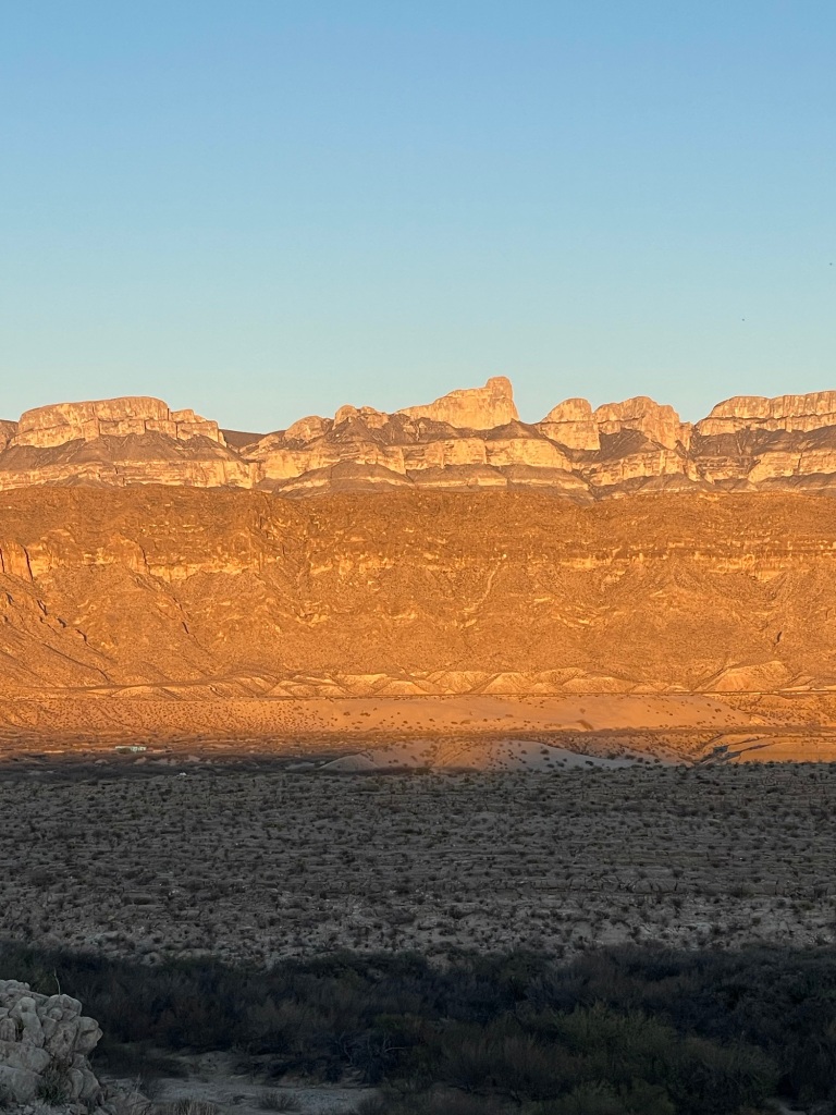
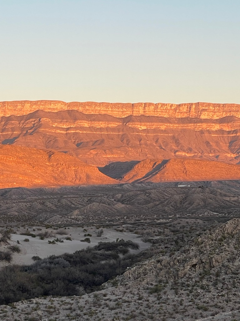
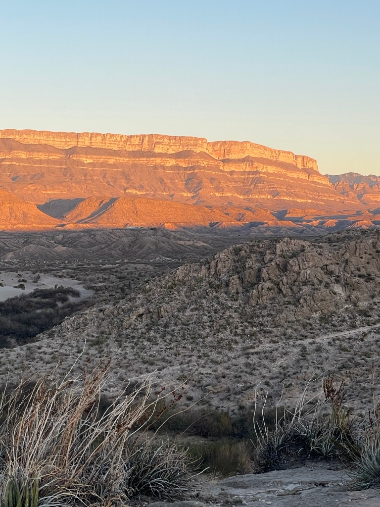
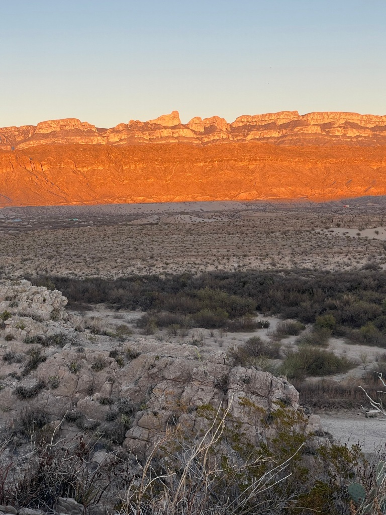
At the Rio Grande Village CG there is a “nature walk” that goes down to the river, but also a little hill to go up and watch the sunset. We got there with plenty of time to enjoy both. If you have good photography equipment take it with you. The Sierra del Carmen range light up with some amazing hues of reds and pinks thanks to the color of the rocks. I came back for my night wander to do some stargazing. It had been way to long since I have had a good dark sky.. While the night sky here is good its not middle of Nevada dark, but it is still pretty good none-the-less. I was just stoked to have a great night sky.
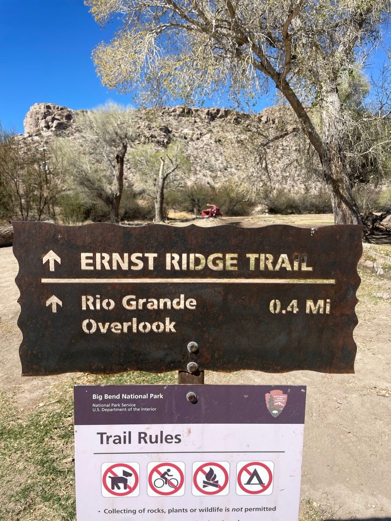
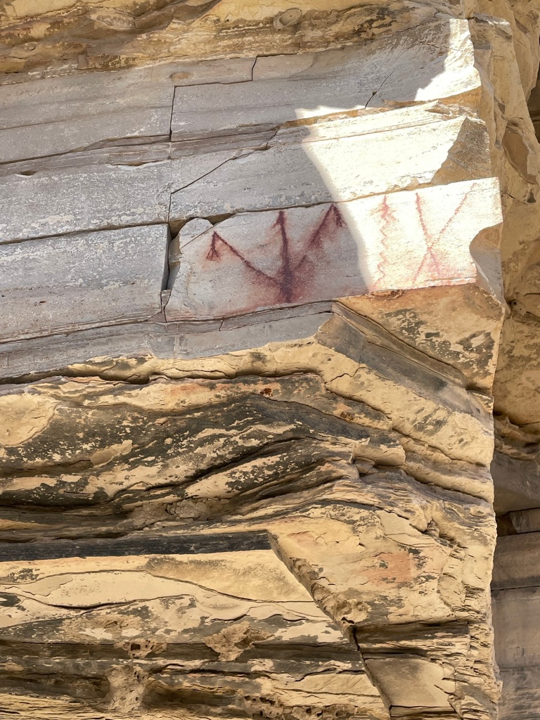
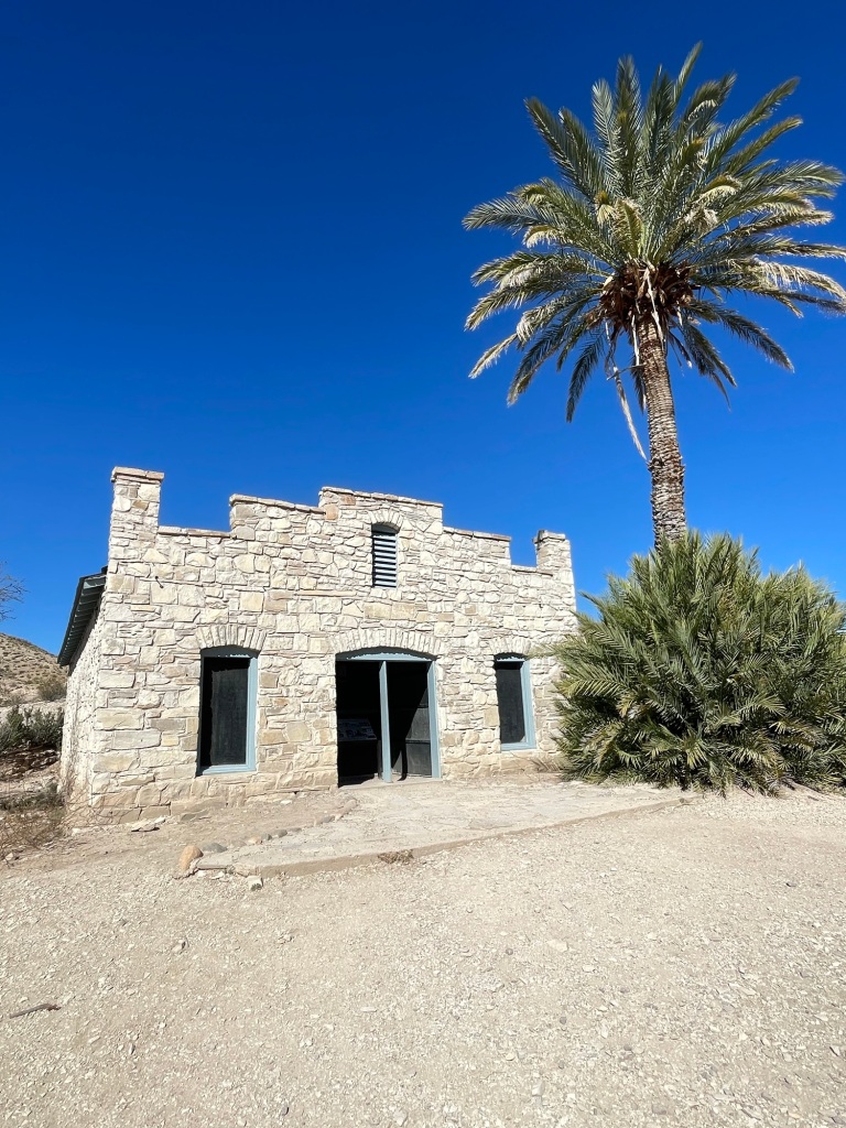
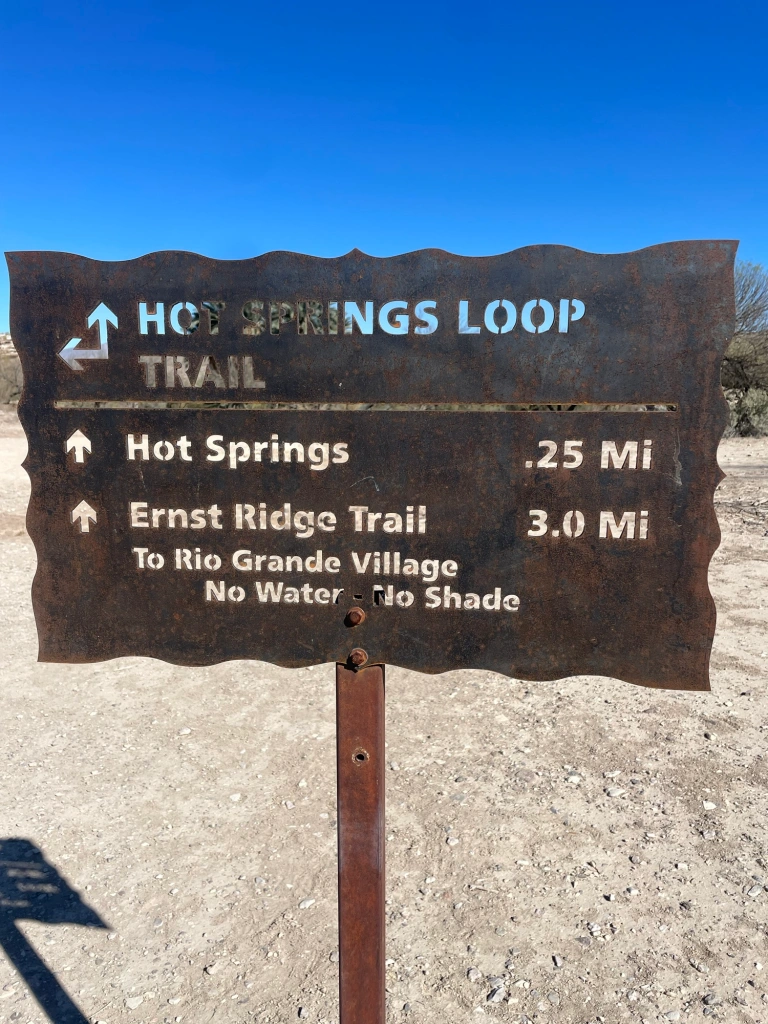
Today was a fun little jaunt along the Rio Grande to the Hot Springs at the end of the trail. It was supposed to be a 6-ish mile out amd back, but we started from the CG so that pushed us closer to 9 miles. This walk offers a lot of interesting site seeing that covers geology as well as natural amd human history. The walk offers great views of the Rio Grande, the Sierra de (mountains), fossils and petroglyphs on the walls around the Hot Springs. Oh yah and hot springs too, which (so and so ) Langford back in the early 1900s created a resort nearby. After lunch amd some time checking out the area history we headed back.
The plan today was to head over towards Grapevine Hills and walk out to a balanced rock, however i checked SOTAmaps and realized I was looking right at a peak. It had been six weeks so the urge overtook me to send Meesh on her way and I opted to run up the hill. One thing i will note is that every kind of plant here wants to stick and prick you whether its a cactus or not. This is not the same as say the whitethorn or manzanita i encounter regularly in Nevada. It was the first peak that I was trying out a new EFRW built with K6ARK’s balun kit. I had been using a linked EFHW for the past couple of years and the polystealth wire was starting to get worse for wear. At the end of the day I wound up with about 30 qsos on 28mhz and 21mhz including on contact with Northern Ireland. Most of the contacts were North American based, so not too bad given the last minute decision and no real alert, or other activators in the hills today. Tomorrow we are headed to the Lost Mine trail and I will snag Casa Grande Peak.
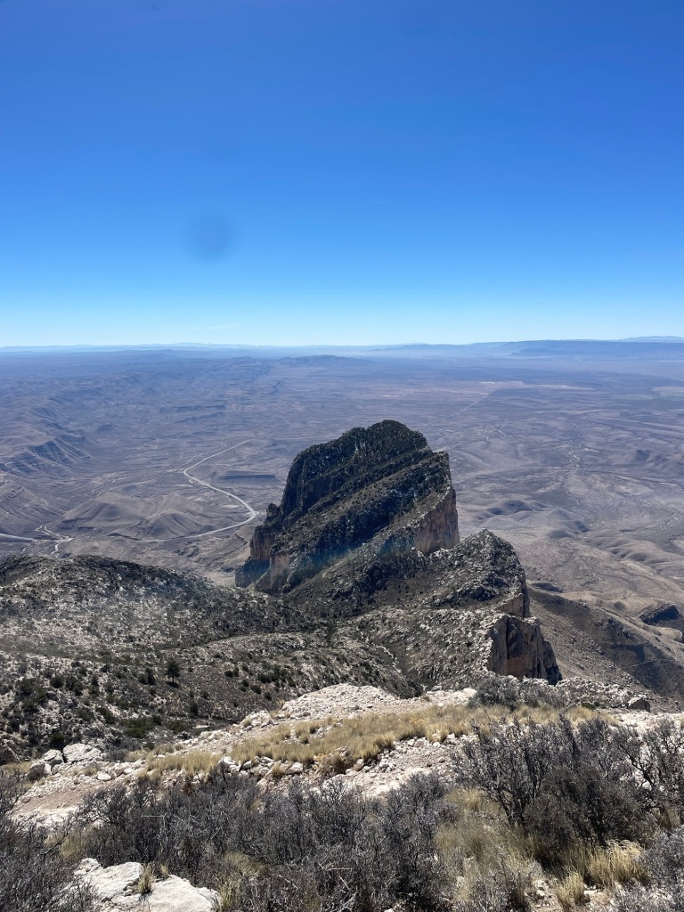
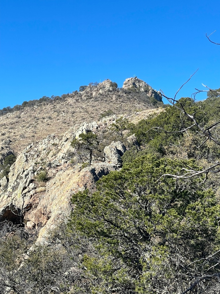
I wanted to do some Summits on the Air after my day on Grapevine Hills, and I had been eyeing Casa Grande or it’s neighbor Lost Mine Peak located in the Chisos Mountains sky island. . After pouring over maps, and data I chose Casa Grande, and to be fair it was the more impressive looking peak overall. I took off ahead of Michele from the parking area as she was not following me up this peak (and for good reason). The first mile you follow the Lost Mine trail, and then turn off onto a no longer maintained almost goat trail to the summit. A goat trail it was, it looks like quite a few people head up this peak such that there are multiple goat trails in the absence of a well flagged/cairn’d route to a peak that has a steep approach. Some of the terrain encountered did include a little bit of class 3/4 scrambling (because I like scrambling solid rock instead of fighting with Talus and Scree), and some talus/scree runs that at least have some trees that can be used for hand holds. Once you get up the last gully the trail levels out pretty good and the last 50 or so feet of elevation is a gradual trail. At one point you cover 500 feet of vertical gain over 700-800 feet of horizontal distance. The summit offers a 360 degree viewpoint as far as the eyes can see. Look South towards the Rio Grande, the Sierra del Carmen range and Mexico, glance across the way at Emory Peak which stands close by (and was done later in the week), so plenty of views to be had. Another successful SOTA activation, so we wont go into that, but lets shift into the down route. Looking downhill you can see quite a few options including where some individuals have just bombed straight down the talus fields, which on the map does cut off a LOT of distance back to the parking lot/trail head. I’m not down with that though as rocks hurt and the angle was steep enough that a controlled descent was just not possible. If you can handle that, more power to you. That said as I was trying to contour around, I did wind up on yet another rock band where I was doing a bit of low grade class V climbing but also having to contort and bend to not end up wearing the prickly pear cacti. I almost managed to get cliffed out at one point too, but found a good animal use trail to finally rejoin the “correct” (old/original) trail back to the Lost Mine trail. All in all it took me longer to get down than get up since I had to do a lot of route finding/navigating off the summit. So be warned if you decide to go after this peak.
Not a lot to really report here, we slow rolled out of Rio Grande Village to Chisos Basin. This is considered “an island in the sky” which I called out above. It was much cooler, but also much more crowded as most people are here to hike some of the trails in the area as well as bag the higher, but easier to reach Emory Peak. There are a plenty of trails to be had here for later days.
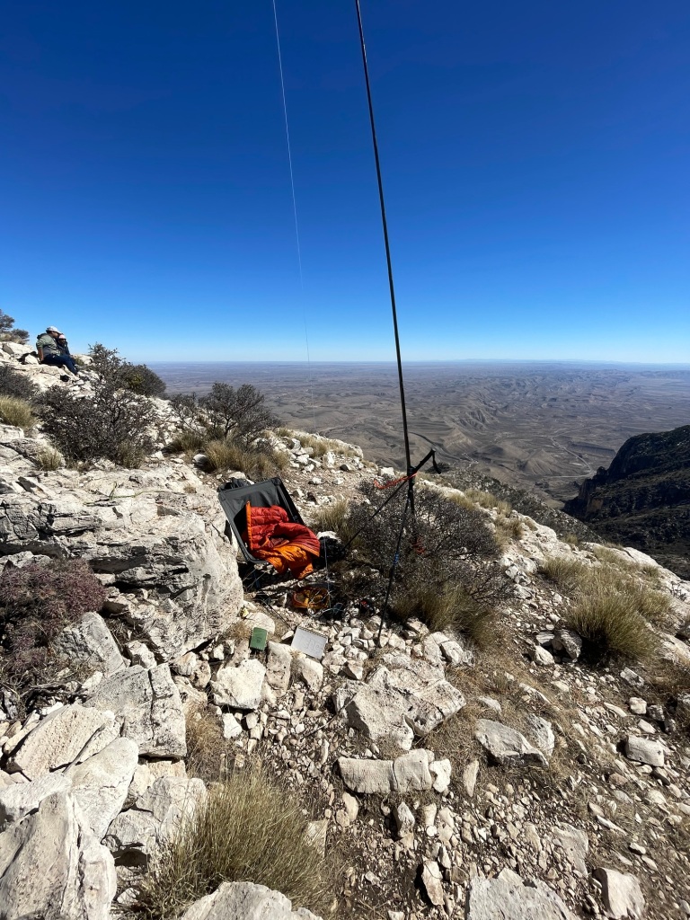
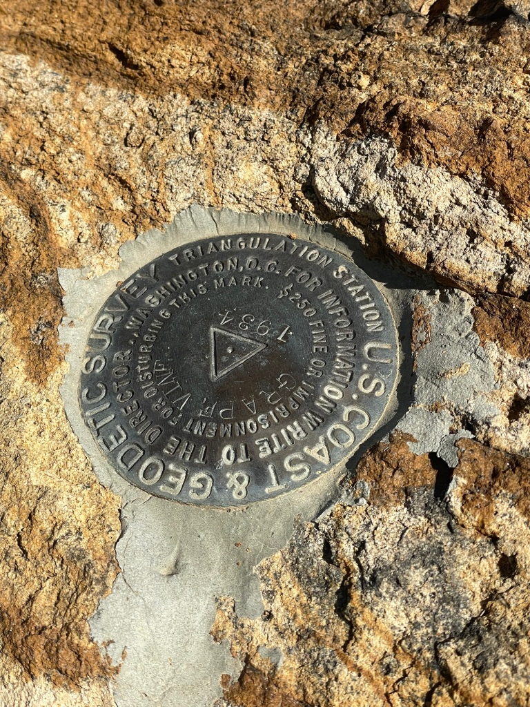
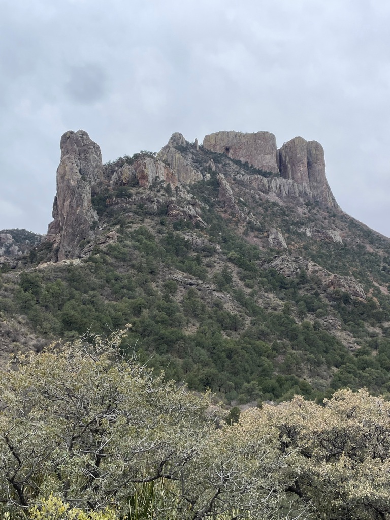
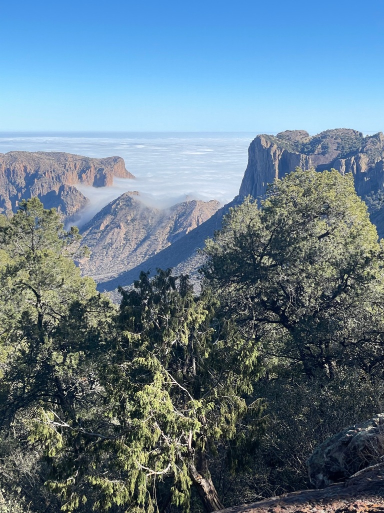
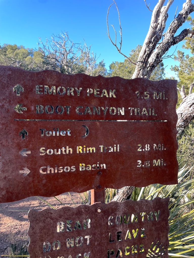
Today’s goal was some Summits on the Air, and the high point of the National Park, and knowing it was a Saturday I wanted to get an early start to keep the crowding on the summit to a minimum while I had an antenna mast up, that and I was starting from the campground, not the Visitor Center area, so that added about 3/4 a mile each way. So on the trail we go with an interesting inversion occuring outside the basin. There was fog/clouds pouring over the Panther Pass area creating a fun misting effect. Fortunately the Emory Peak side of the basin was without the inversion, so views were had all around. I was well ahead of the crowds so far and made it to the trail junction in about 2 hours of walking. This trail junction has a pretty posh setup, there are bear boxes right there, an AED and a nearby privy. Onwards and upwards, the trail stays pretty moderate until the last little bit where the final push for the summit is 2-3 minutes of solid rock scrambling (class IV climbing) onto the top of the summit block. There are two blocks, the taller one is to the right/North when standing between them, or from a visual perspective, the one that contains the radio systems. Speaking of radio systems, one of the antennas was being held up with 5mm paracord..I guess if it works, it works. the USGS marker is close to an edge, but not too crazy. Note that there are sheer drops on the Western side of both summit blocks, so be advised if you have issues with exposure. (actually if you have issues with exposure do not bother with the climb up, but enjoy the saddle as a place to rest, grab lunch etc. It is possible to activate from the saddle, but it will be harder to be out of the way given that some folks will go after both summit blocks. Pretty straight forward SOTA day, 28mhz/10M got me France, Sweden, Germany, Spain and the UK for DX, and the usual suspects from about North America. By the time I wrapped up and started heading down the crowds were really ascending on the summit. It took a good 10 minutes to get off the summit block as I had to wait for a window to sneak down in between groups heading up. Something to be aware of regardless of your intentions for the summit. Pretty much the same story at the trail junction as well, easily 100+ people hanging out, having lunch and resting before the final push up. Note that the Pinnacle’s trail provides access to the South Rim Loop, and many other backcountry campsites, so most people were dropping packs into the bear boxes to snag Emory as part of their outing. Had some enjoyable conversations with individuals on my down walk, including someone sporting the brand new Durston Kakwa 55. This individual was working his way to Florida to put his few remaining possessions in storage and was headed up the AT this spring. He was doing a three day shake down trip to try out the new gear here in Big Bend, and he could not have picked a better place for it..
However we had time for one last hike on the Window View Trail which is accessed directly from the campground, so we were like a 30 second walk to that TH. This is a pretty short trail that goes to a very cool feature. The trail ends at the top of a waterfall. note that the rock is pretty polished, so even when the creek is dry test your footing as you approach the edge. It is a pretty short trail, but note you descend down to the waterfall, the return is a climb of about 500-600 feet of elevation gain that’s pretty much sun exposed. So if it is summer, carry copius amounts of water and consume it. We made it back to the campground around noon, so with that we decided to head on out of town to cut our drive time to Guadalupe down.
Big Bend was pretty damn impressive. I would totally return there, especially with the backpack and check out the South Rim loop, (note that from Feb thru April that trail is closed because of Falcon nesting). It would be fun to put together a 5-6 day loop, during the new moon to really get that star gazing in. I will note, that while this area is good for stargazing and I had some great dark sky nights I still find the skies in Nevada to be darker and clearer. If Big Bend is on your list and you have the time, doing a 7-10 day trip is very possible spending 3-4 nights in each of the three campgrounds. While we never made it to the Cottonwood campground, what I can say is that Chisos vs Rio Grande Village offered two completely different experiences and moving between them was super easy.
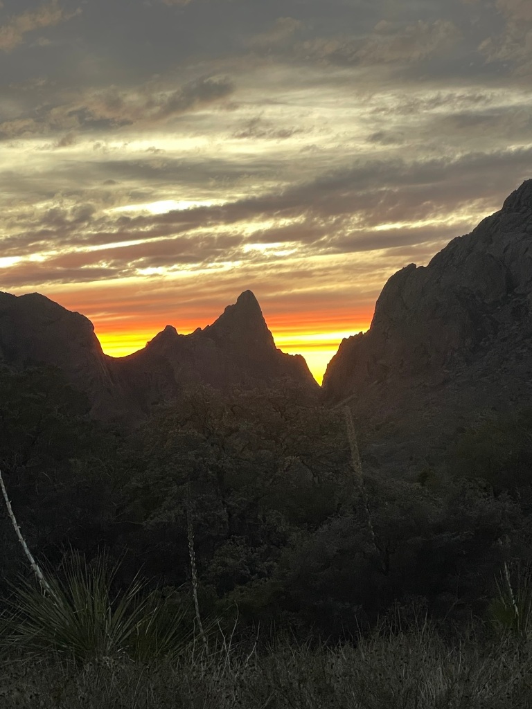
A few remaining shots of some sunsets, and random wild life.
Up Next: Guadalupe Mountains National Park, and the Texas State high point.
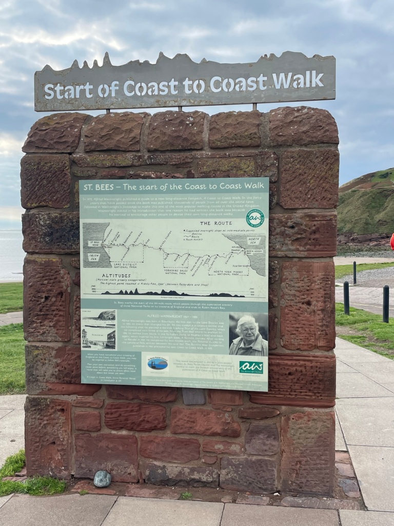
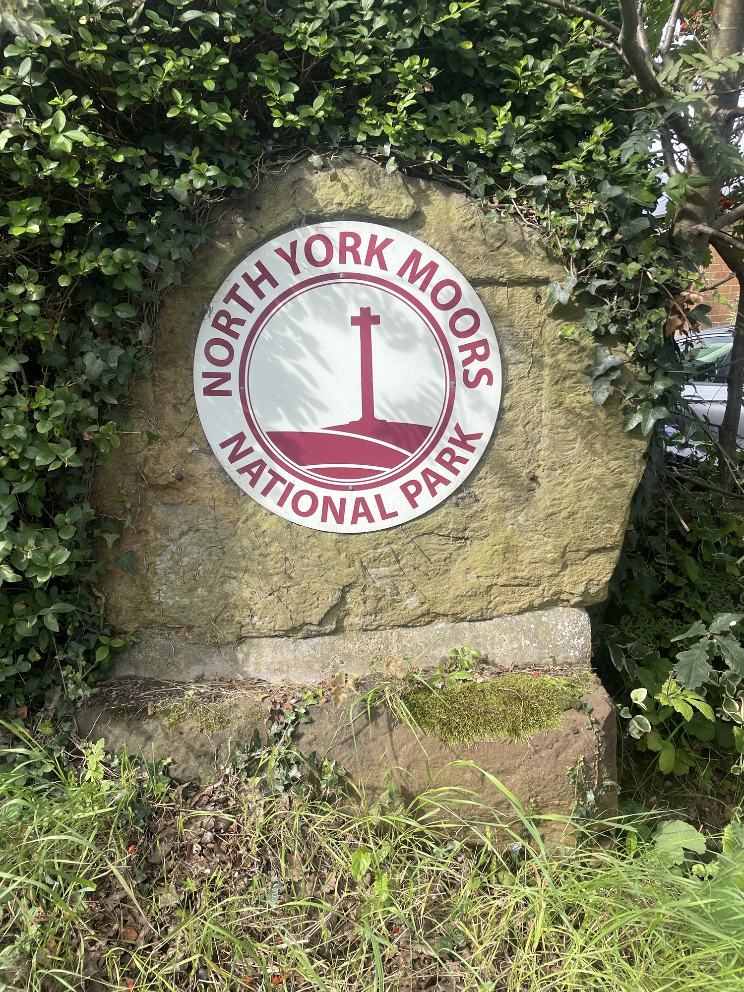
A plan is good, however a plan (in my experience) only gets you to the trailhead; once you put boots (trail shoes) to the ground then chances are things are going to change. That has been my mantra for years because well that’s how it happens. My saunter up the West Highland Way in 2022 was the closest I have ever come to pulling off perfect execution of “a plan”. Primarily because that one involved stays in INNs, and side trips up peaks doing a fair bit of Summits on the Air. At the end of the day that trip was a very well logistically planned trip both in miles per day walked and in vertical elevation of my summit days. So fast forward about nine months and let us add a little spice to the mix. That is right, the wife wanted to join me on a walk across England along the Wainwright’s Coast to Coast because for both of us, it was our first time to the N York Moors as well as the Yorkshire Dales. I did a fair amount of research leading up to summer guide season so that by the time I was immersed in work I only needed to reference the spreadsheet and book stays here and there to continue filling in those last few columns.
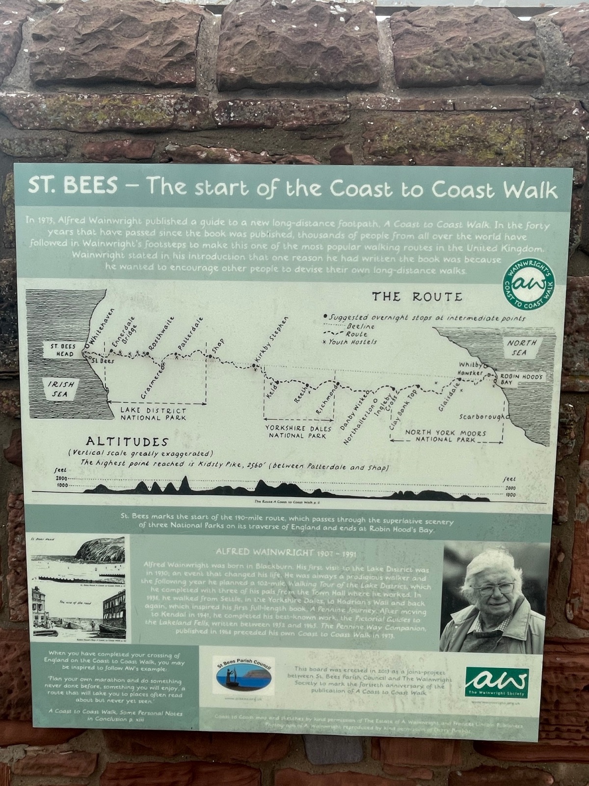
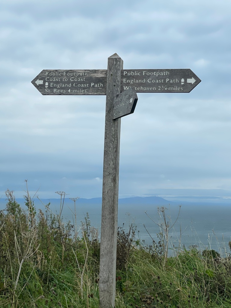
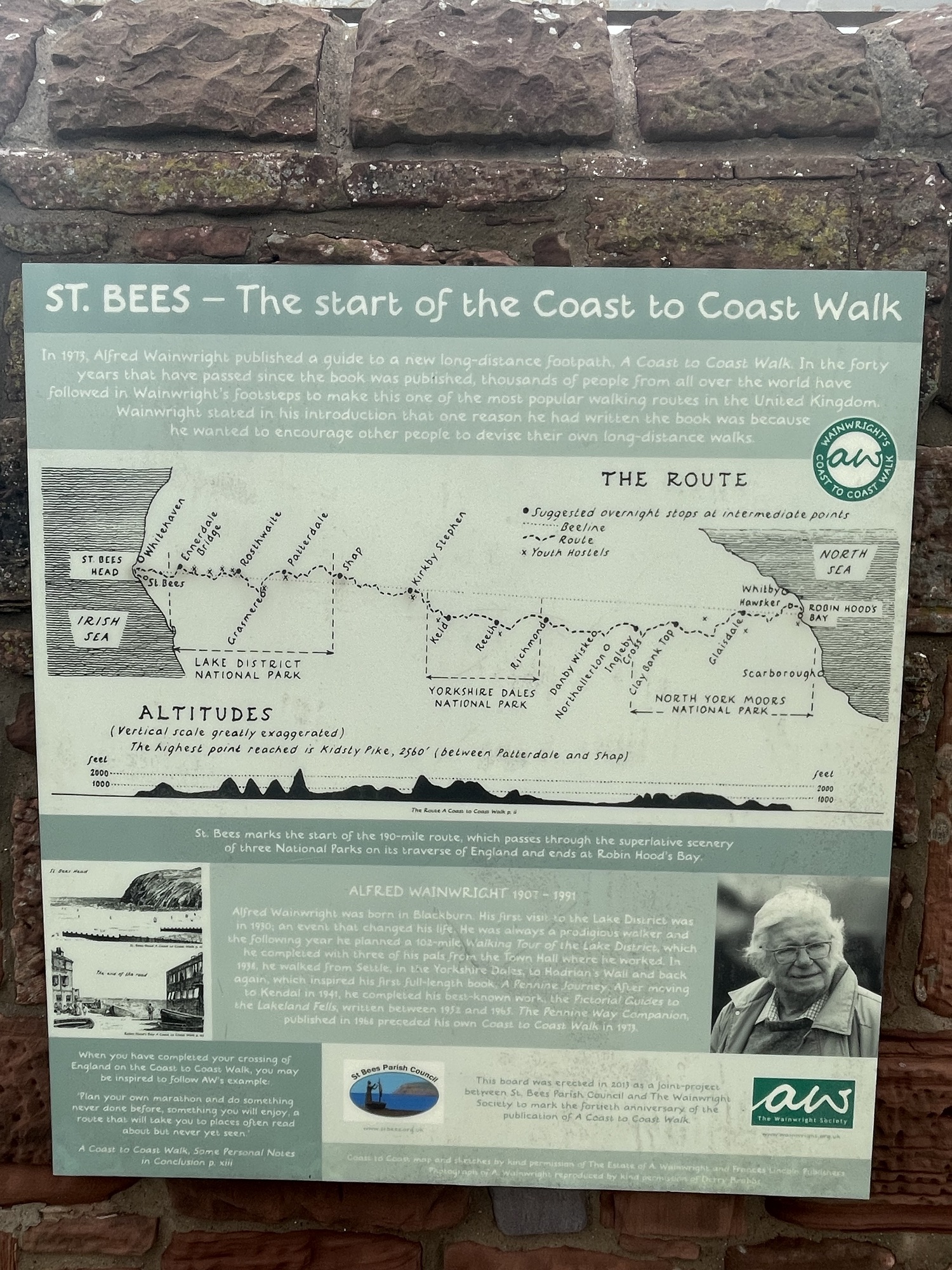
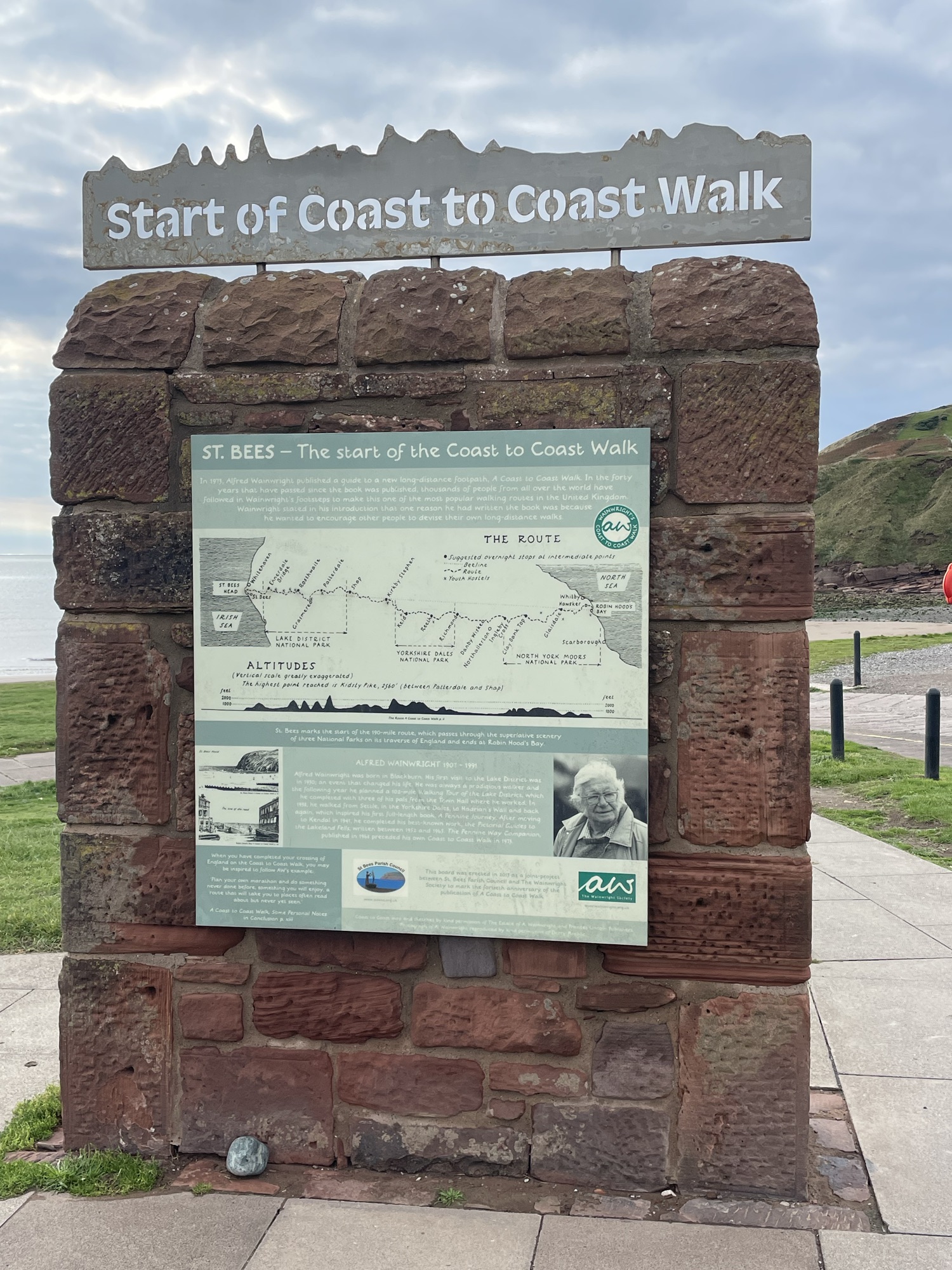
The Coast to Coast Walk, What is it?
The C2C is an approximate 180 mile West to East route that starts in St Bee’s and finishes in Robin Hood’s Bay. The walker starts at the Irish Sea, heads off into the Lake District National Park, over through the Yorkshire Dales and then into the North York Moors before finishing off on at the North Sea. It is encouraged that walkers dip their boots into the waters of each sea upon start and completion. We did end up making a few variations, for starters because I personally love the Lake District National Park, and know that the terrain of the LD is harder than the locations to the East, I figured it would be better for both of us to build up before reaching that area. Also I was hoping to add an interesting variation I found a while back called The “Peaks to Pubs” circumnavigating the Lake District before rejoining the preferred C2C and resuming our Westward jaunt. One of the main reasons individuals walk towards the East is because of the prevailing winds off the Irish Sea. All in all this walk should take 12-15 days for an average walker. If you are not familiar with European walking, you can pay a service to ferry your bags for you based upon your itinerary as well. I think a few of those services will even develop your itinerary and send you a pdf “route card” to boot, at least that was what it looked like with some of the people I passed. That said, the Coast to Coast with the wife in tow had a pretty good plan with most of the logistics already taken care of, but even then things did change.
The Planning Process:
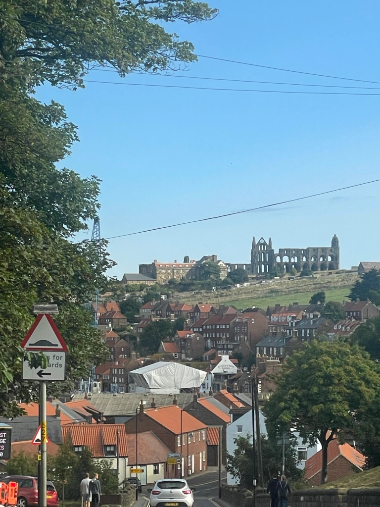
The plan was to come off guide season, head over to the UK, spend a few days getting to Robin Hood’s Bay Whitby, and begin our westward journey. Okay what’s the deal? Why is Robin Hood’s Bay striked out and Whitby was added? Well, RHB is a pretty small town overall and I managed to put our start date right smack dab in the middle of a bank holiday weekend. So by the time I got around to booking that stay everything was taken up. That said, Whitby was on our list of places to visit because of the Magpie Cafe. I am a bit of a fan of English style Haddock Fish and Chips, and found a list on TasteAtlas of the best locations in the world for Fish and Chips. So we opted to spend an extra day here, and check out the Abbey and then start moving along. It also meant for a slightly shorter day 1 since our first night stay was at Egton, which from RHB was a 17 mile (29km) walk. We only walked 12 (19km) instead.
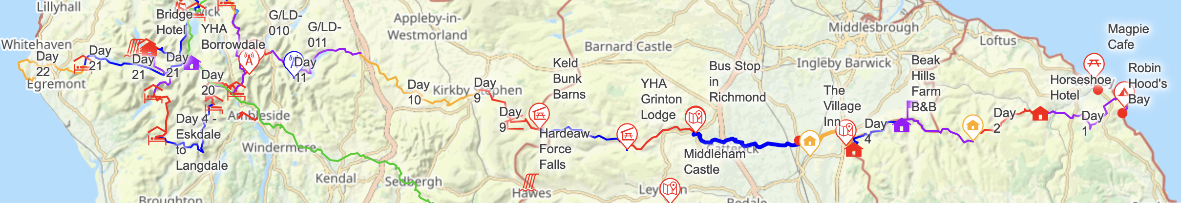
The rest of our days laid out as follows
| Day # | Start | Finish | Distance Miles (km) |
|---|---|---|---|
| 1 | Whitby | Egton | 12 (19) |
| 2 | Egton | Blakely | 12 (19) |
| 3 | Blakely | Beak Hills | 12 (19) |
| 4 | Beak Hills | Osmotherly | 10 (16) |
| 5 | Osmotherly | Brompton | 11 (18) |
| 6 | Brompton | Richmond | 17 (27) |
| 7 | Richmond | Grinton | 12 (19) |
| 8 | Grinton | Keld | 14 (23) |
| 9 | Keld | Kirkby Stephen | 12 (19) |
| 10 | Kirkby Stephen | Shap | 21 (34) |
| 11 | Shap | Patterdale | 17 (27) |
| 12 | Patterdale | Threkeld | 14 (23) |
| 13 | Threkeld | Keswick | 12 (19) |
| 14 | Keswick | Buttermere | 12 (19) |
| 15 | Buttermere | Wasdale | 9 (15) |
| 16 | Wasdale | Ambleside | 1o (16) |
| 17 | Ambleside | Langdale | 15 (24) |
| 18 | Langdale | Grasmere | 10 (16) |
| 19 | Grasmere | Borrowdale | 11 (18) |
| 20 | Borrowdale | Ennerdale Bridge | 17 (27) |
| 21 | Ennerdale Bridge | St Bee’s | 14 (23) |
The plan is set, the places were booked, a mix of YHA Hostels, BnB’s based upon the recommendations of the Peaks to Pubs, and whatever else was available.
Once in Whitby we did the tourist thing, saw the Abbey which is well worth the visit, especially during their show and how it relates to Bram Stoker’s Dracula. We also hit up the Quayside for Fish and Chips. If you are not familiar with the Fish and Chips in these sea side towns, understand that the fish we were eating was caught that morning, tossed across the street from the boat dock to the restaurant and fried up. I would suspect that fish was out of the water less than 5 hours by the time it ended up in my gullet. Whitby is quite the cute little British holiday town, bigger than a village and similar to some of the places we have been in Cornwall and is where a lot of people head for a long weekend to get away. It was busy for sure.
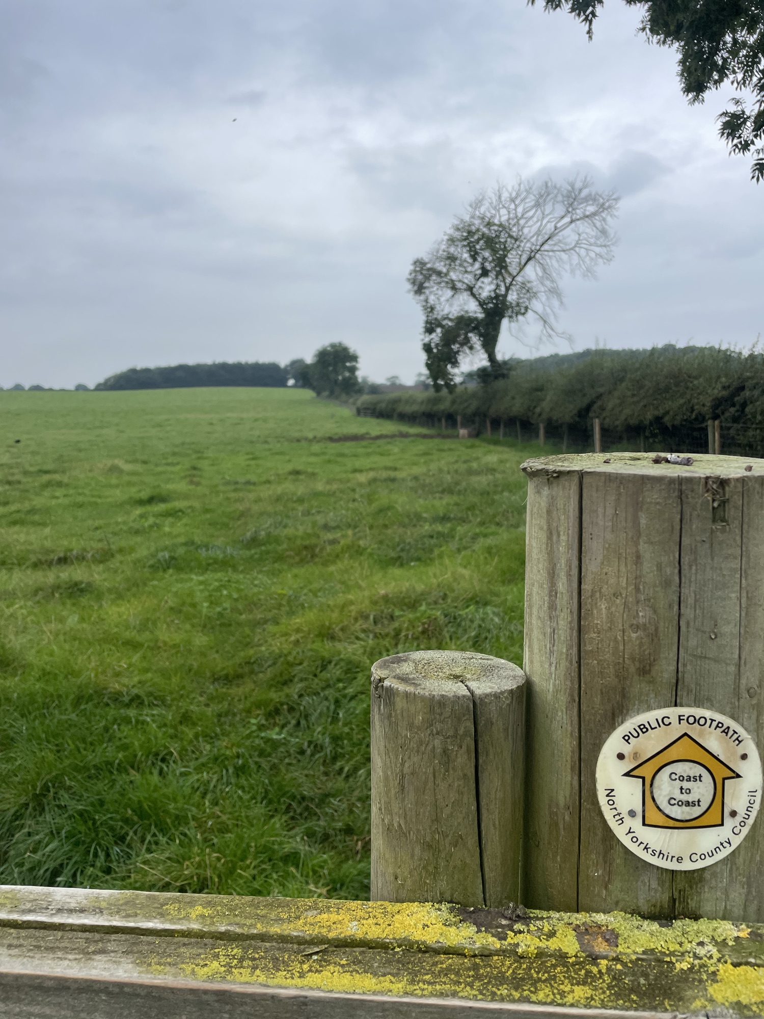
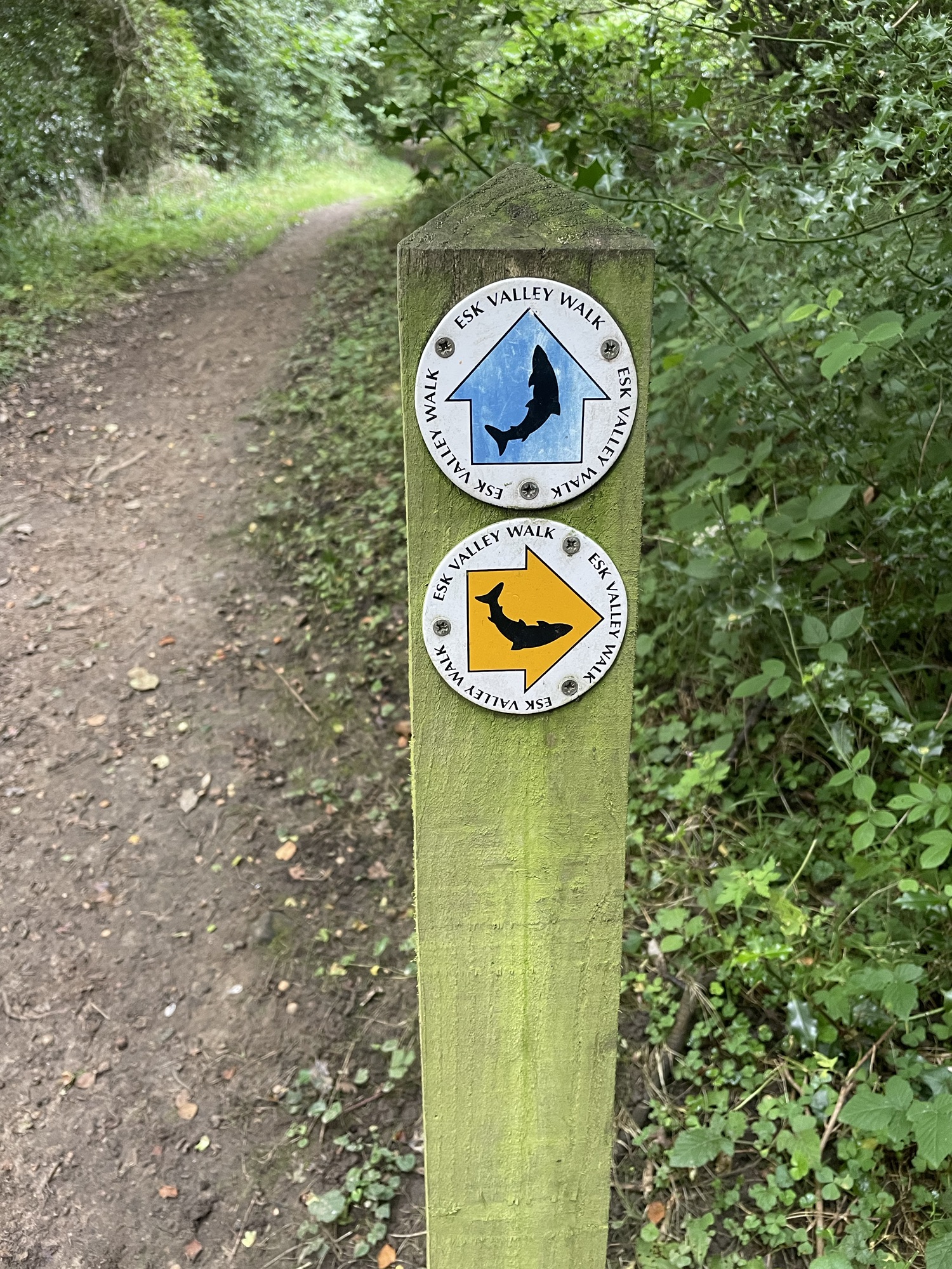
Day 1: On our start day we walked all the way out to the end of the pier, not quite the same as dipping the boots in the North Sea, but we were out over the water. We walked along what is listed as the “Esk Valley Walk” until Grosmont where we did the typical English thing and had a nice ice cream break. We entered the North York Moors at Sleights. That night we stayed at the Horseshoe Hotel which sits right on the River Esk. They were having a Sunday pig roast for dinner, so yes please. A lot of the walking today was still urban-ish until we crossed into the N York Moors. Once away from the coast the villages become smaller, and the environment is much quieter.
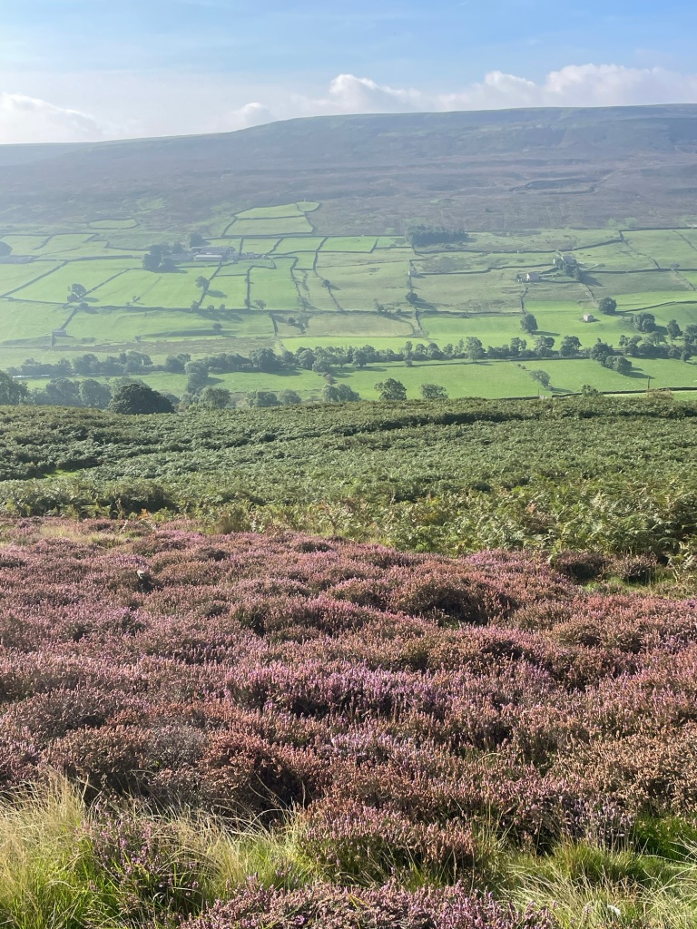
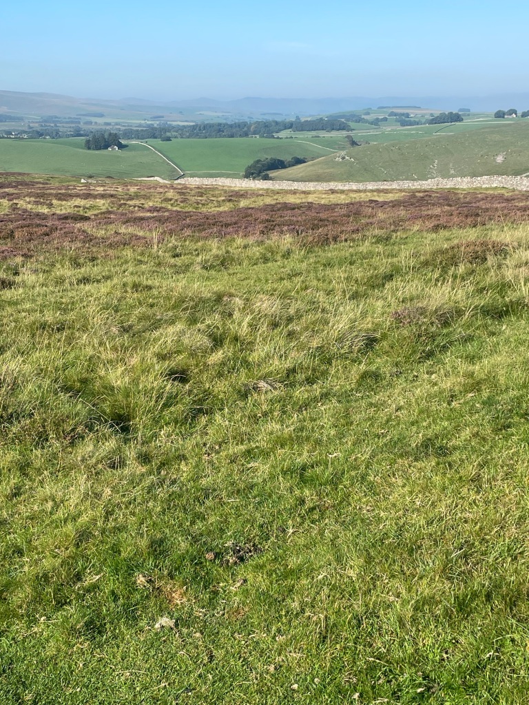
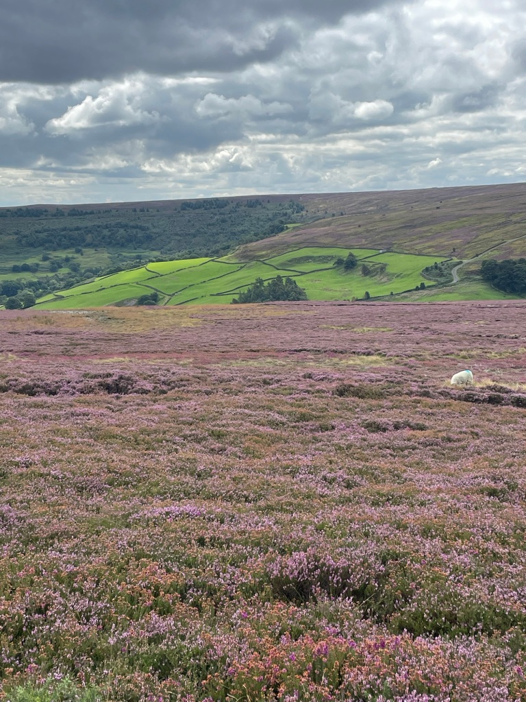
Day 2: Continuing on westward, and because we are finally on the C2c proper we are finally running into those “walking it normally”. It was definitely a conversation starter when we noted we were going E to W (and why). Most people agreed with the reasoning though having tackled those Lake stages early on. The goal today is make it to the Lion Inn on Blakely Ridge. Unless you are wild camping this is the only place to stay unless you want to push on a few extra miles. This was also the day where we made it to those open rolling hills of Heather giving off a wonderful purple hue. It was also nice that we could still see the North Sea anytime we turned around. A lot of this day you spend on the ‘Inn Way’, but the last couple of miles are on the Lyke Wake Walk. We found out what that means with the BnB we stayed at on the third night. The last bit of this day also ends up being some amount of road walking, and this being the Monday of the Bank Holiday, it did end up being a tad busy as folks were still heading back to York (I assume) from the long weekend.
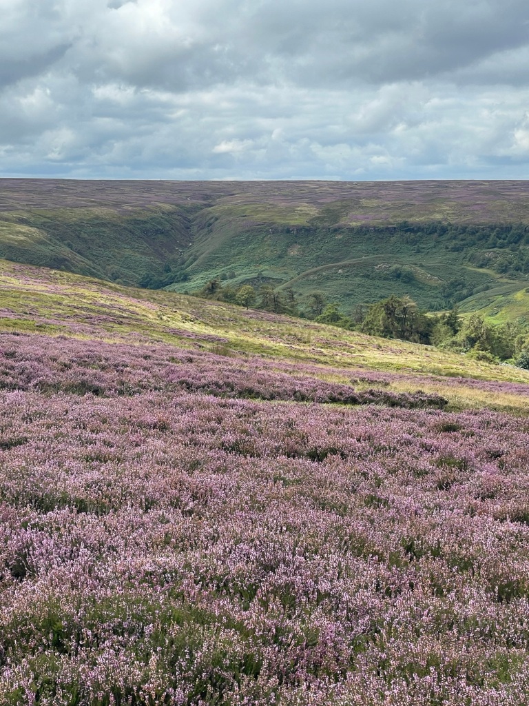

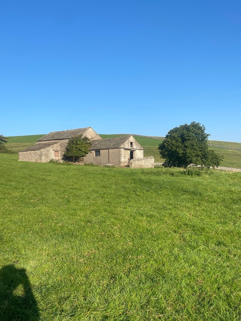
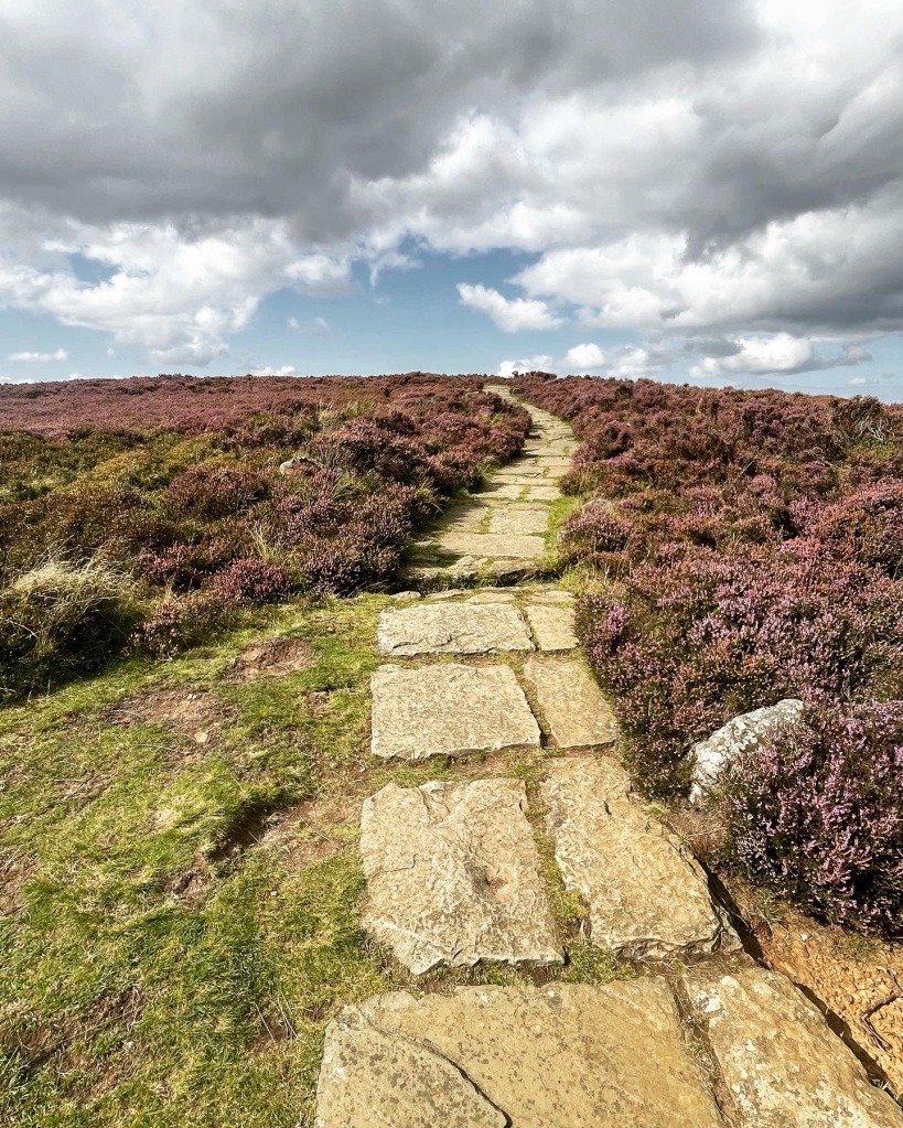
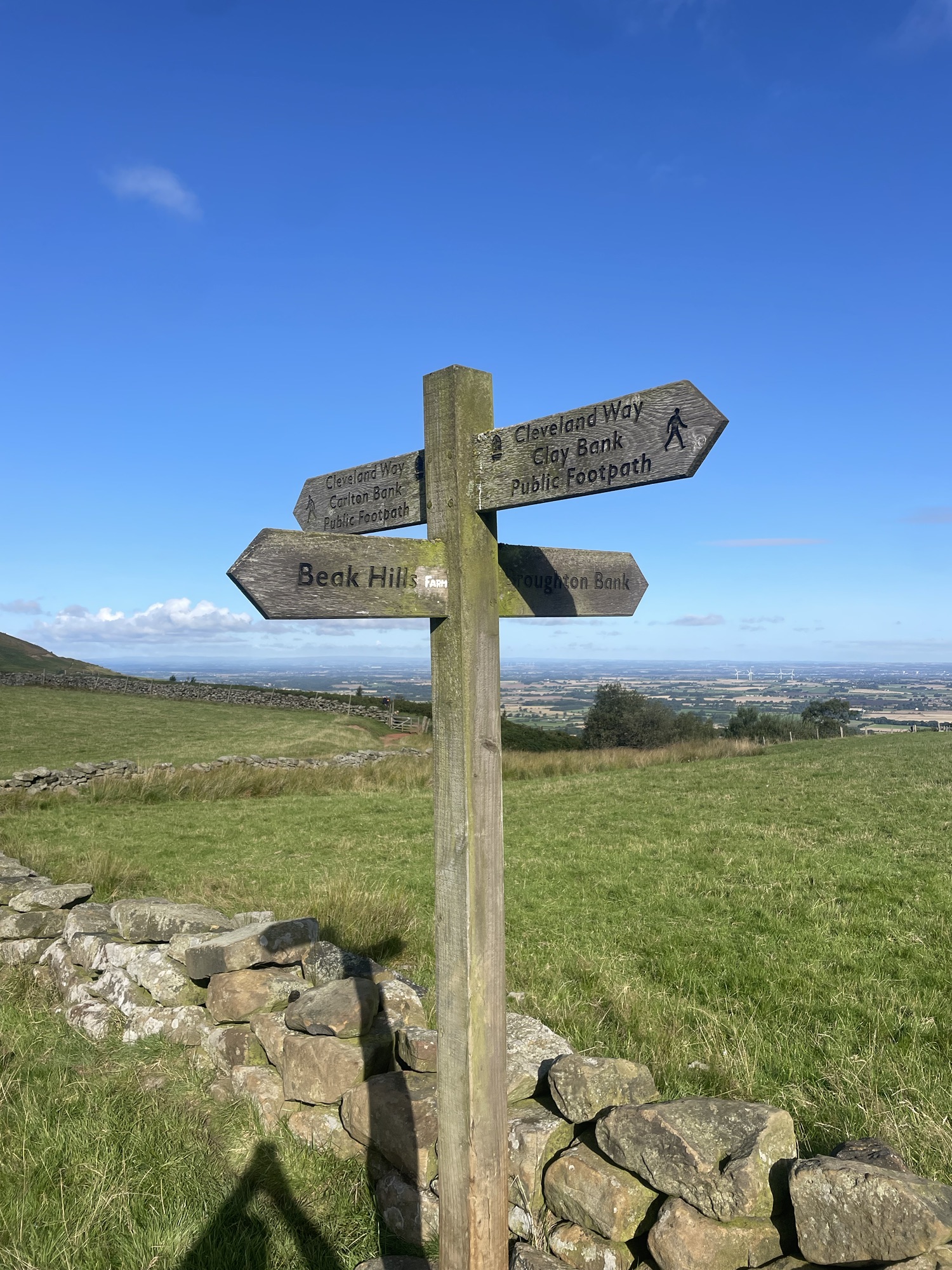
Day 3: Onward to Beak Hills BnB. we finally leave the pavement and head overland for more rolling heather covered hills. The views go on for miles, and as the picture to the left notes plenty of views to be had. The Beak Hills BnB is about 1/2 mile off the main track, but the signage will show you the way. The setting of the farm is amazing, and they have the usual farm animals one would expect for an area like this (Sheep, Horses, etc.). This ended up being my second favorite stay on our journey.

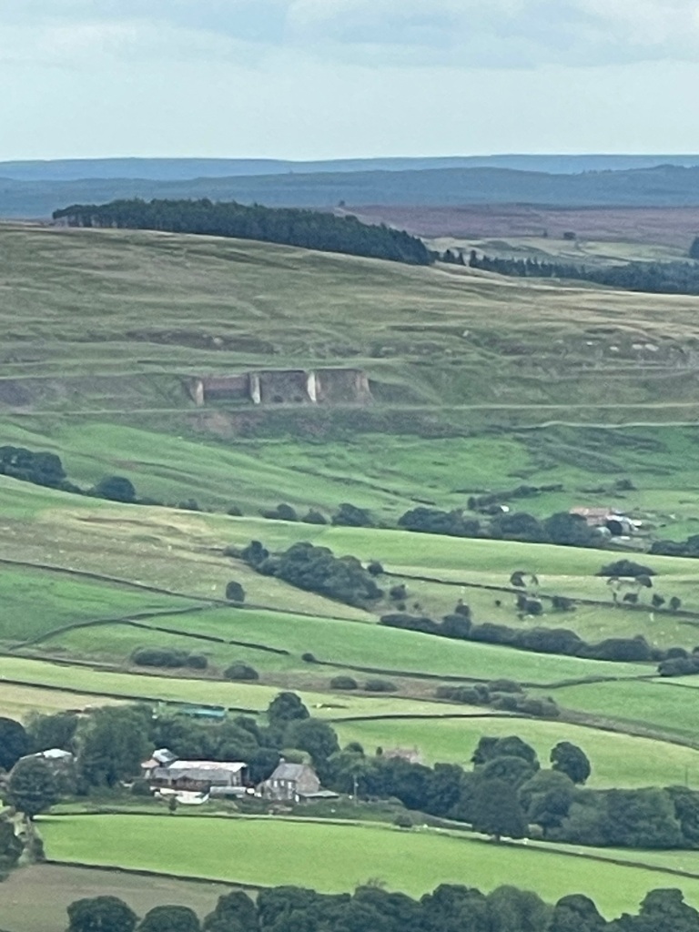
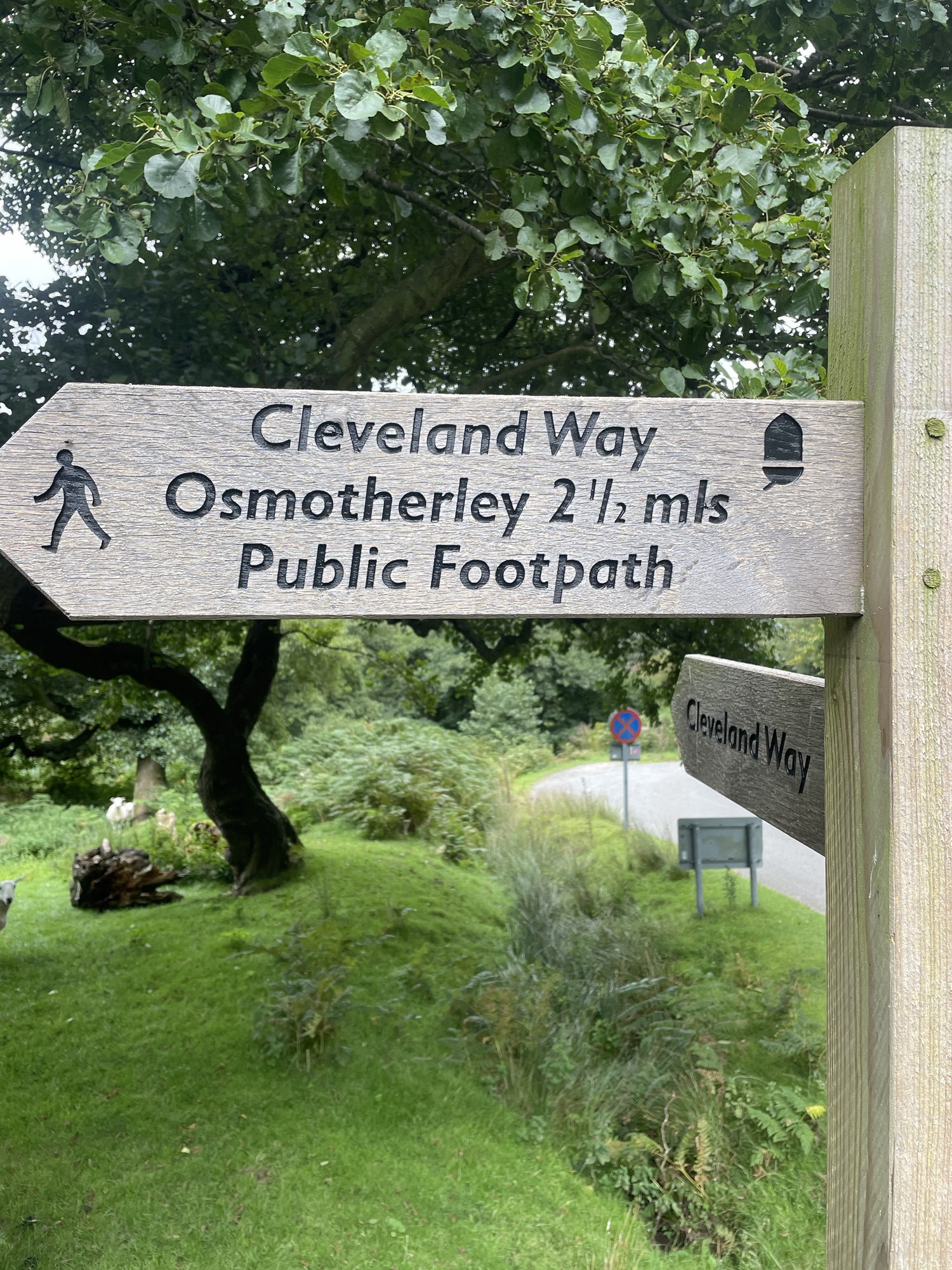
Day 4: The destination today is the YHA in Osmotherley, another iconic English village. We walked along the Cleveland Way (still on the C2C, but signage especially for the direction we were going was spotty at best. Wainwright first tossed out the concept of the C2C back in the 1970s, however it was 2022 that it was finally certified as a National Trail. The C2C organization is actively working on getting signage put up along the pathway. In Osmotherley we made a decision to reconfigure our walking baggage and engaged a baggage service to send everything else to St Bee’s to wait for us at the end. Because this was a pick up and ferry to the end, this only added about £40 to our trip. I shoved the clothes we would use into my AtomPack’s Mo, as well as my Hilltop Pack’s foodbag for carrying our lunch/snacks for walking and my walking partner was using a 10L bum bag to carry some of our other odds and ends. We started the walk carrying everything including Laptop, my portable radio gear etc, so we were able to ditch about 15-20kg for the duration of our trip. Osmotherley YHA, this Hostel is private, but affiliated with the YHA in England/Wales however this might have been one of the nicer YHA’s I have stayed at in England. They have a plush lounge and a very nice self catering kitchen. Osmotherley is also the Western Edge of the North York Moors, the next couple of days is through some farming lands and is a bit flat.
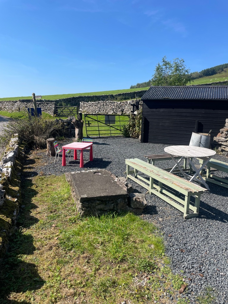
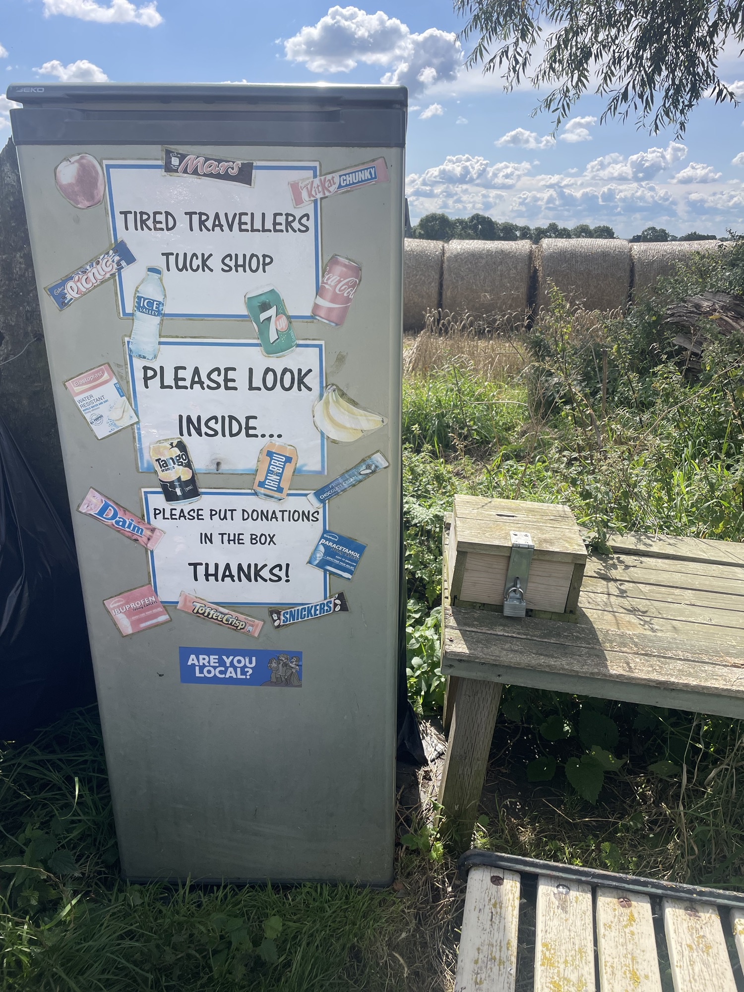
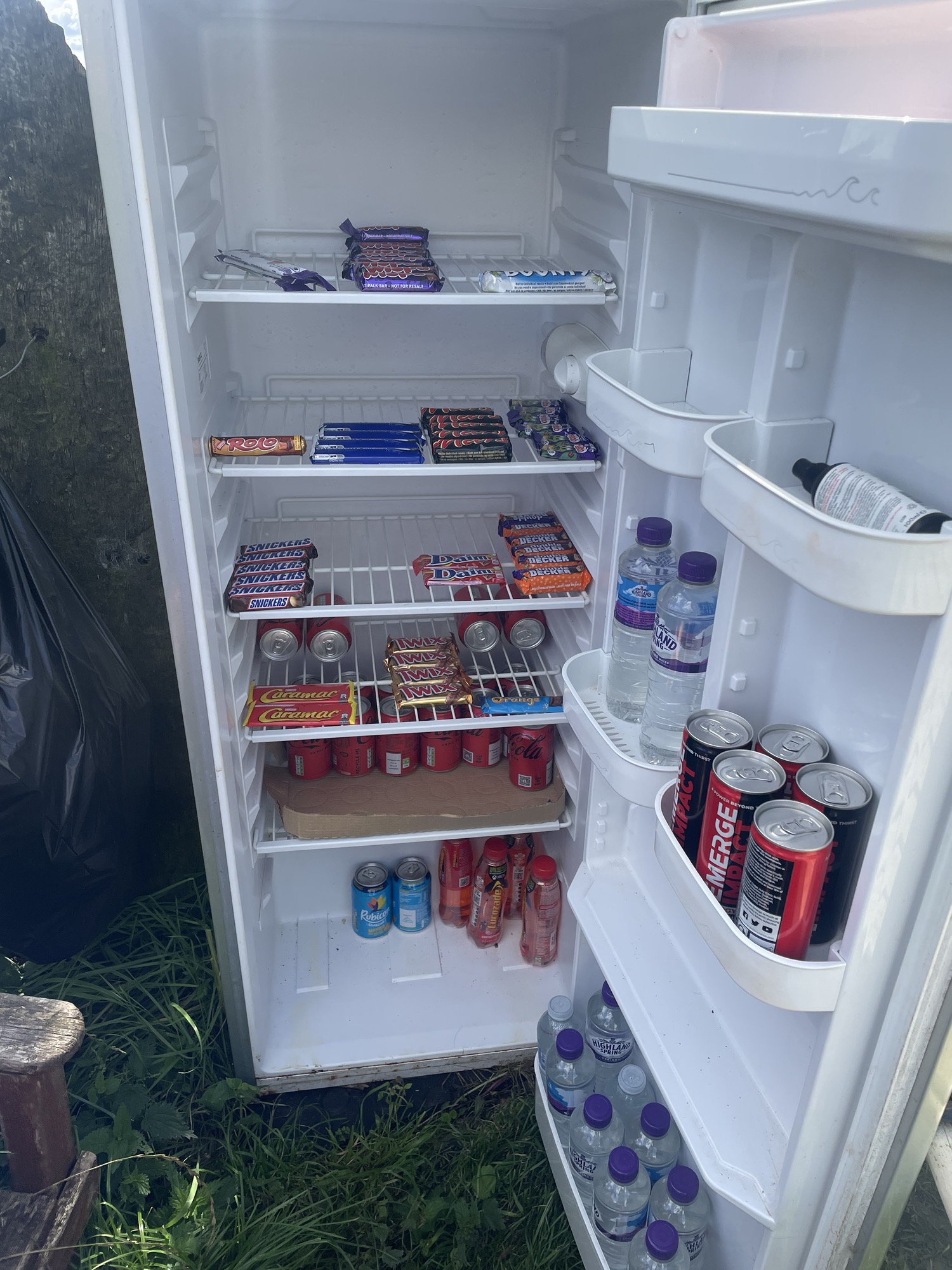
Day 5: Most guides have you stay in Danby Wiske, however I found there to be limited places to stay. I did not get something booked soon enough so we ended up with a few extra steps wandering down to Brompton. The walk out of Osmotherley goes through Arncliffe wood. One of the few areas where you do have some tree cover (not a lot just some). Along this Wood is “The Lady Chapel”. This is worth the stop over, as this chapel (like most) has an interesting story, and does have some affiliation with the Mount Grace Priory down the hill. After checking out the grounds you continue on down into the valley for a while. If you have walked the UK before you may be aware of honesty boxes. If not, individuals will usually put out some snacks, maybe some water bottles or soda’s near the trail. I may have come across the coolest honesty box yet. Aside from the fully stocked fridge of all kinds of beverages there were also chocolate bars and salty snacks. No Magnum Ice Cream bars though. What was cool is how they decorated up the stop, including some lawn chairs for relaxation.
If you can manage Danby Wiske, it is worth it, Brompton was a bit of a run down town, so not a lot to report there. We ended up doing about 12 miles today with some of that being to leave the C2C cooridor to get to Brompton.

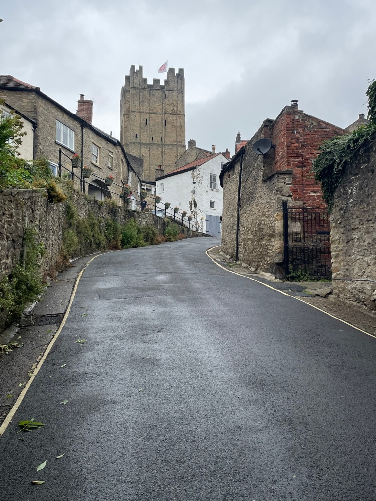
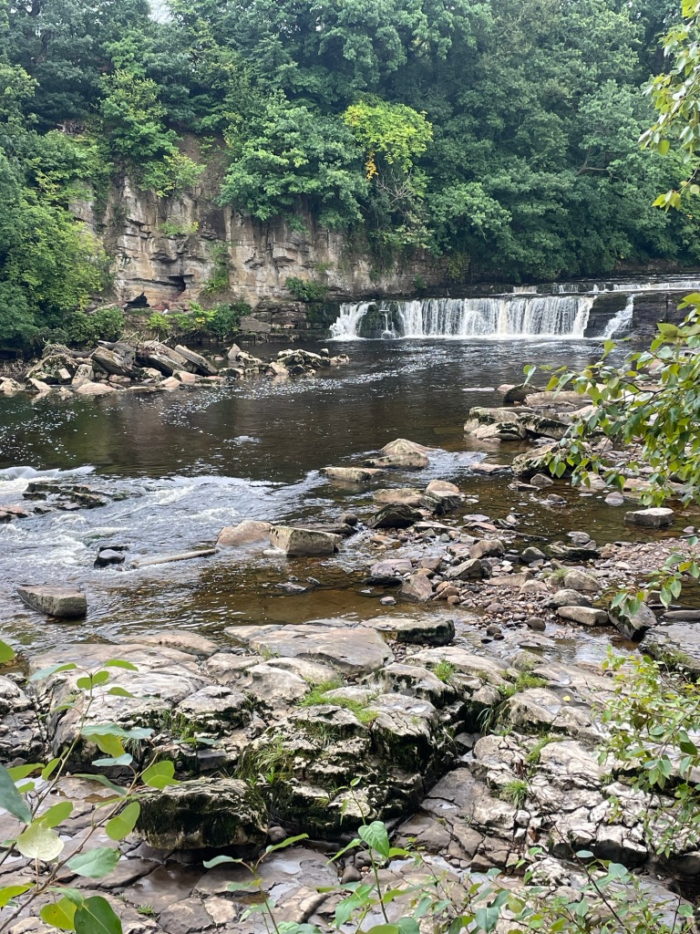
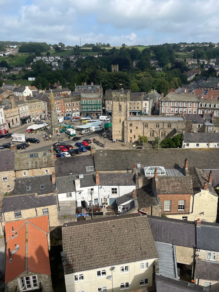
Day 6: Richmond! Today was the first longer day I’d put on the books, a whopping 17 miles. Michele opted to go do a “culture” day and I do not blame her, but I really wanted to push those miles because I had a 20 miler day coming up soon. After getting a bus back to within 1/2 mile of the C2C cooridor I set off. Today was threatening rain and at one point it did sprinkle…for about 5 minutes. There was a lot of walking along pasture land, so not the most picturesque day of the walk for me. However when you get to Bolton on Swale, take the time to check out the outside of St Mary’s Church. The roofline makes for some very interesting geometry/visual effects. I probably only noticed this because I was walking towards the west. Had I been walking East I would have missed the view captured above. Continuing along you follow the River Swale and things do start to get a bit more interesting again, and I found Richmond to be one of the more beautiful (non Lake District) Towns along the path. We also happened to be staying in Richmond on a Friday night which meant Saturday was Market Day. If you have control over your timing, I would encourage being in Richmond for a Saturday morning. British Market Towns are a wondrous thing. In the US we call them Farmers Markets, a good chance to stock up on some local food faire for those mid day walk snacks. We picked up some cheeses, water crackers, smoked haddock and apples. It is worth it to check out the water falls at the bottom of the hill beneath the castle on the walk out of town. Better yet just check out the castle, and look down from the various high points of the castle grounds for views of the town center as well as the country side and river.

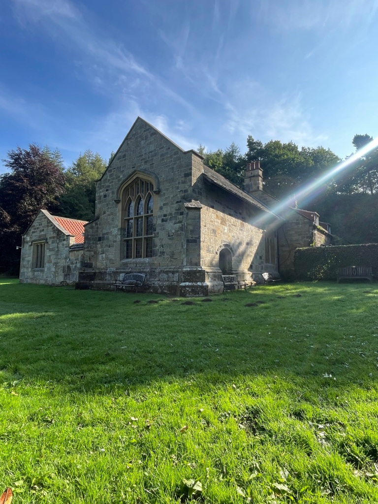
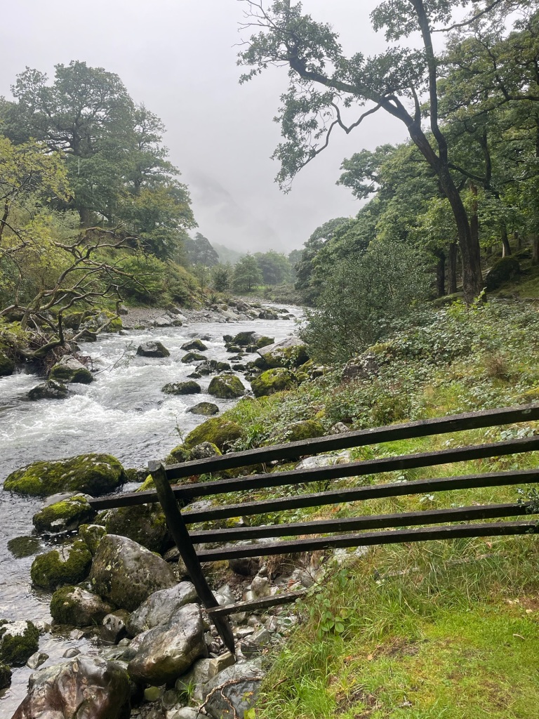
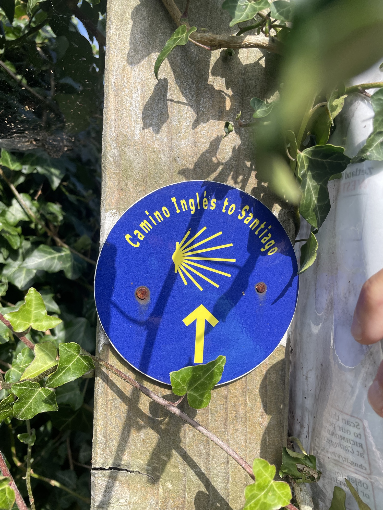
Day 7: After hitting the various vendors at the market we pushed onwards towards Grinton, we were staying at another YHA that looked like a castle. I really enjoy the character of the various YHA’s. Now to be fair I have stayed in a couple of stinkers but for the most part the YHA’s have served me well. We did start out on a bit of pavement leaving the town center, and we even crossed a marker for the Camino Ingles de Santiago. We only had about 10 miles today and we started late enough that we sat down and enjoyed some of the goodies we picked up at the market square on the Western edge of town. There are plenty of benches along the stretch that are placed right next to the trail. We were finally getting back into some hill-ish country and at some point we entered the Yorkshire Dales. This day totally reminded me of the “over the hills and through the woods, to grandmother’s house we go” song as the feel is very much that. We had been in a heat wave the last few days and fortunately the chapel in Marske makes for a refreshing quick stop. They run an honesty shop there that can take tap to pay, but you can also leave a cash donation in the church collection box too. Plus the chapel was quite cool on the inside. They had the usual assortment of soda’s, bottled water, crisps and candy bars. The location of this chapel is what makes it a good spot to stop. You have just come down a hill and are about to climb another (remember that “over the hills” bit I mentioned? If headed westward, there is a sheep pen at the top of the hill in Marrick where you need to turn right and go through to stay on track. It is okay if you miss it though, you will end up on some pavement that loops back around, but the side trip does add about a 1/2 mile. The turn is a reroute that’s not well beat in yet. After this we dropped down into the Steps Wood and rejoined the River Swale the rest of the way into Reeth, then we turned p one more hill to the YHA about 3/4 a mile away.
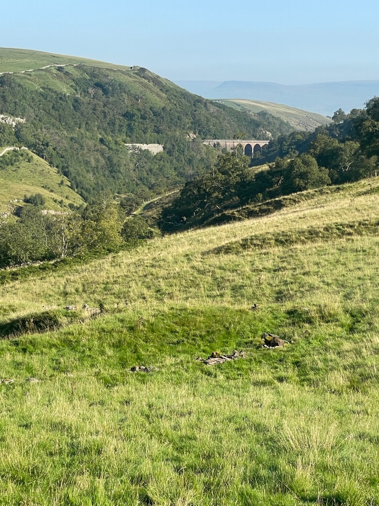
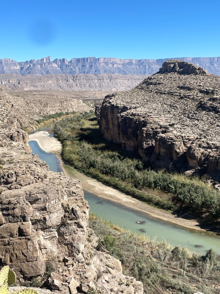
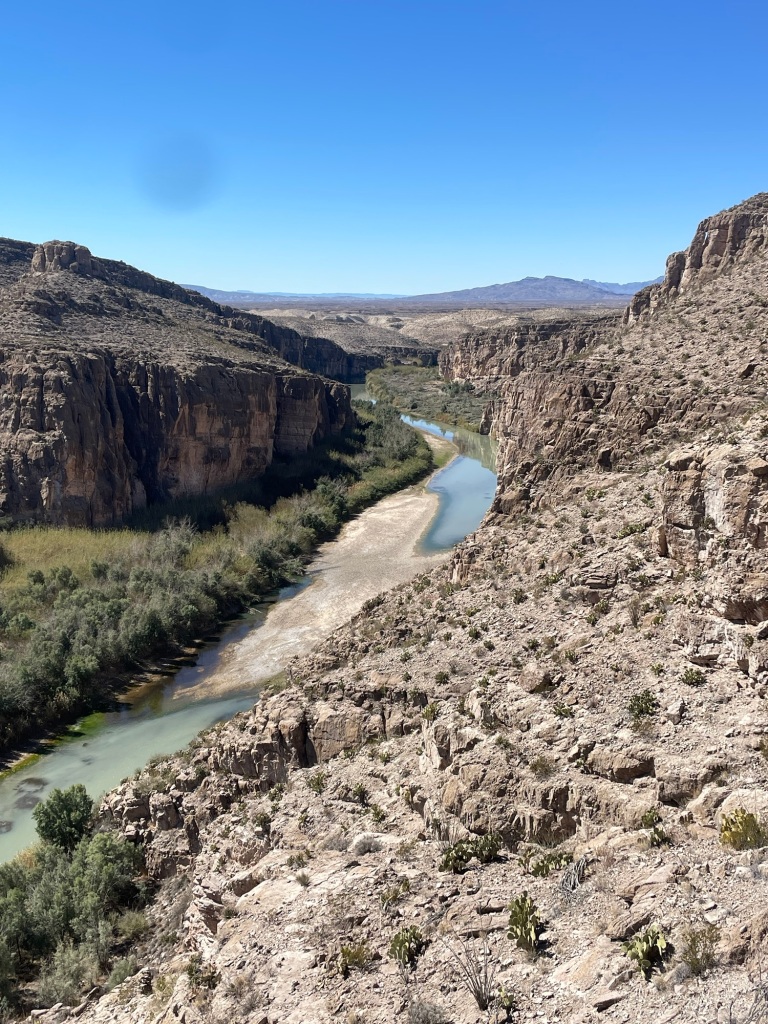
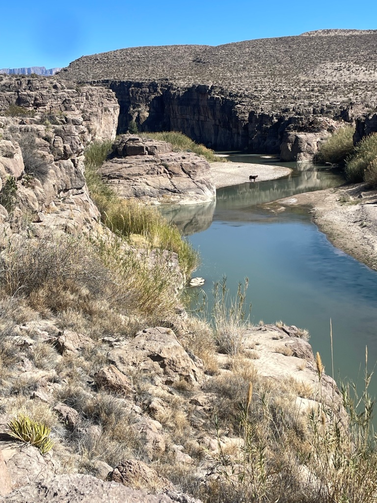
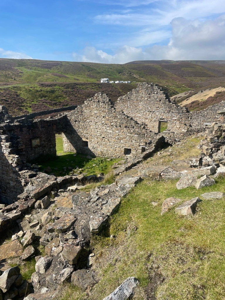
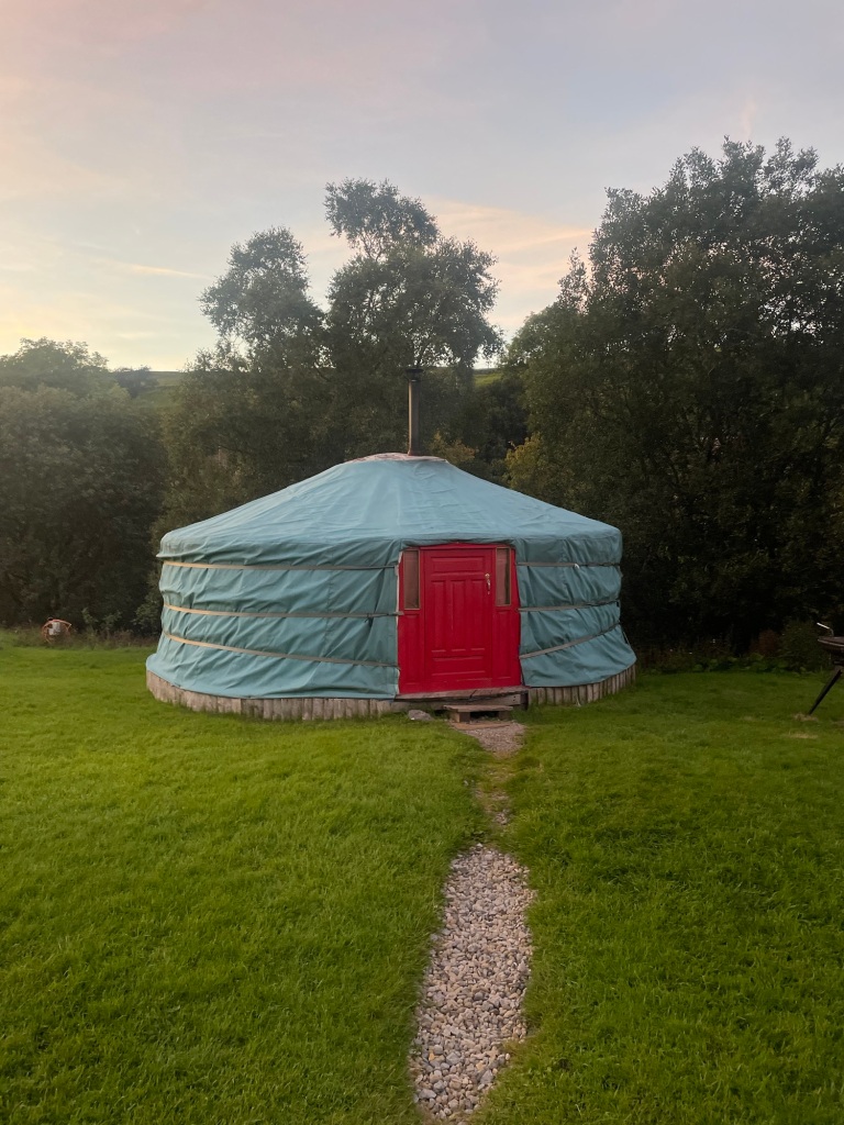
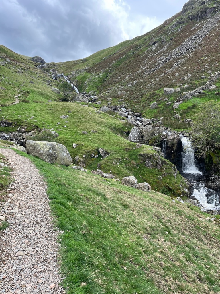
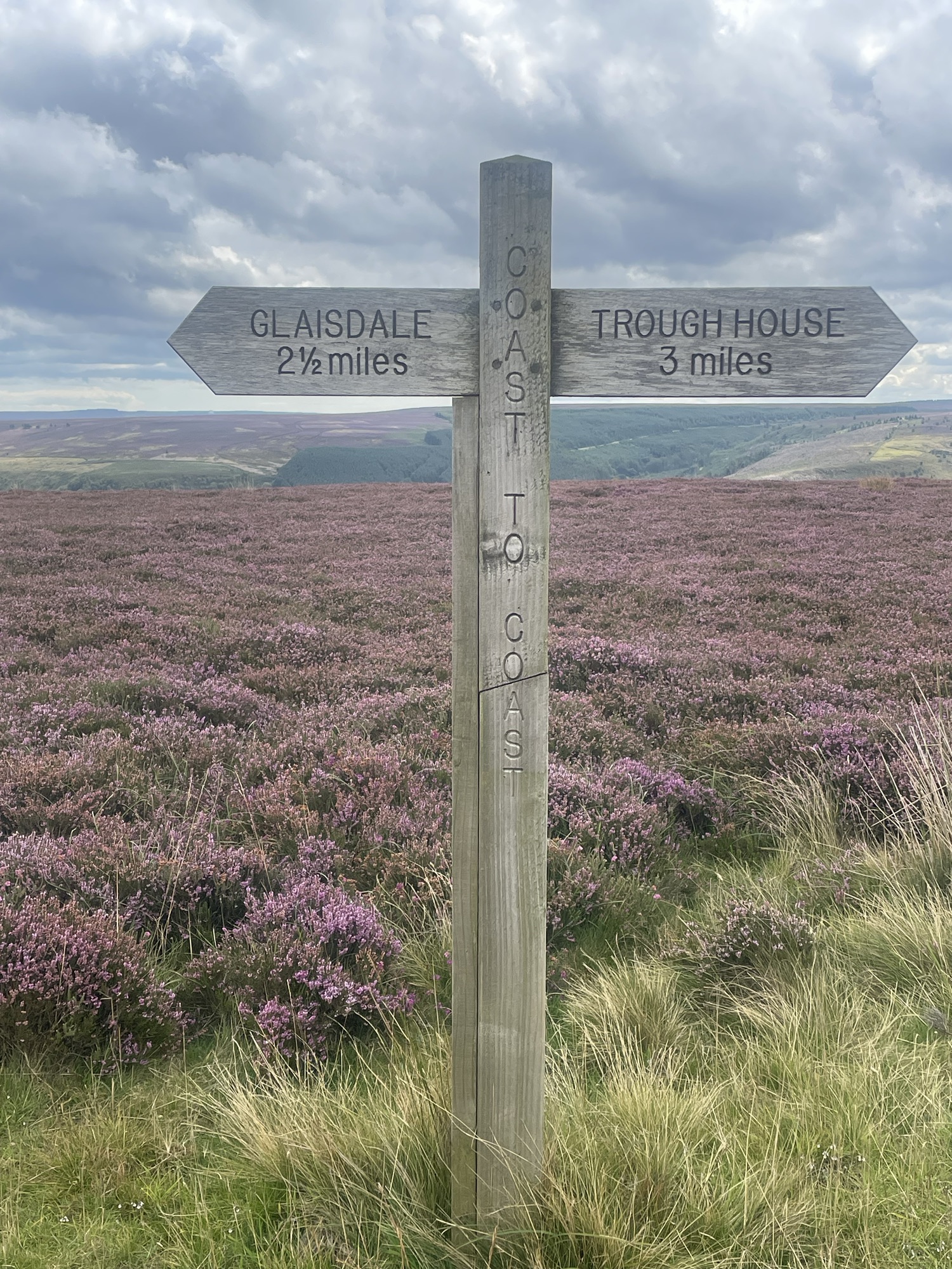
Day 8: If you have ever heard of the book series “All creatures Great and Small” then the walk between Grinton and Keld is worth paying attention. Part of the walk today shares the path with the Northern leg of the “Herriot Way”. I have never watched the series, but I had heard it/seen it available on Britbox or Acorn or one of those streaming services we get in the US. This segment is getting into more of a backcountry experience too, no real towns to be had. The double track dirt path was pretty hard on the feet, and in some cases the area almost seemed like a moon scape. Take time to check out the Brakethwaite Mill Ancient memorial. Back in the 1800s the area was used to smelt lead ore given it’s access to plentiful water. Nowadays it is just a nice watering hole to relax and take a break before the next climb up. We were staying in Keld tonight, another town without a lot of stay options. There are a couple of pubs so be on it. However if you miss out on those there is the Keld Bunk Barn. They have a Bunk Barn and Yurts and do a good job feeding you. It’s also on this segment that you cross the Pennine Way, yet another bucket list walk to do. Supposedly if you walk about 4-5 miles N on the Pennine Way you reach Tan Hill which contains Britains Highest Inn/Pub. I was unaware of this at the time, but if I had known we may have built in some time to explore that way and would have been worth an extra day to go up stay and come back down.
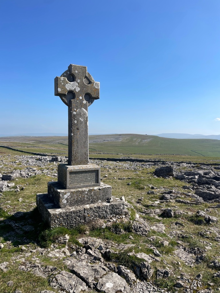
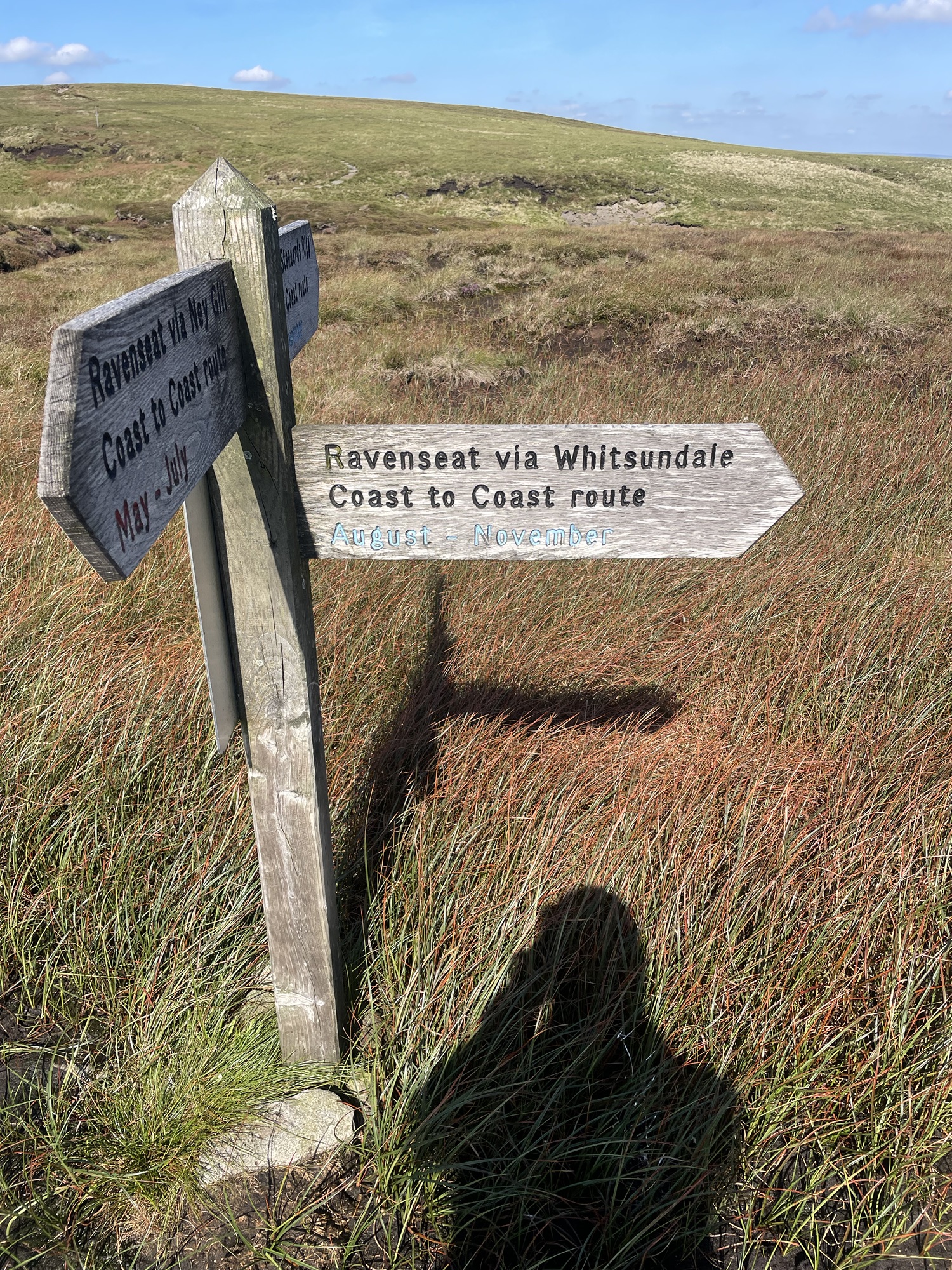
Day 9: Remember what I said above about the lack of signage? Today it presented itself as a real problem as the segment between Kirby Stephen and Keld has seasonal routes. Coming from the West the signage is great (as we found out). Between Ravenseat and Nine Standard Rigg there are three possibilities depending on the time of year for getting around White Mossy Hill. Speaking of Ravenseat if you are not familiar with the story of this farm, go check it out, I had been following her on IG for a while however the farm was currently shut for personal reasons. Coming out of Ravenseat though we ended up on the segment that was currently a full on bog, and it took us longer than it should have to get over White Mossy Hill. Along the many fields there is a bothy which is a nice spot for lunch as well. Also of note is the Nine Standard Rigg (pictured to the left). We stopped here for lunch before our final descent down the hill into Kirby Stephen. Getting back into these hills is where (for me) the fun was beginning again.

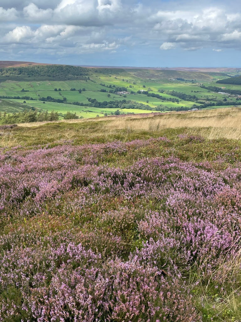
Day 10: The walk to Shap was another solo walk day for me, twenty or so miles on the agenda. It is possible to split this day, but it does require a side trip off the main C2C pathway. There are two towns that each are only about a mile off the main C2C corridor, Ravenstonedale or Newbiggin-on-Lune (I love the town names of the UK). So walking away from Shap the terrain turns into more rolling hills used as pastureland. I found it to be enjoyable for views, the Heather was still adding purple highlights to the fields. The grass was oh so green, and the stone just a wonderful contrast of colors against the blue skies. After a few hours it’s time to take a well deserved break at Sunbiggin Farm. There is a small shack with a fridge and the owners will usually put out some home baked muffins as well as the usual assortment of crisps and candy bars, and the best variety of beverages yet. Take the time to read the story of how this afternoon stop over came to be. I warn you though, watch out for the little four legged beggar, if he does not steal your sandwich, he’ll definitely steal your heart! From here to Patterdale I opted to keep a higher route because I like the views. I ended up stumbling upon a beacon marker that commemorated something to do with Queen Victoria, eventually you come along side then cross over the M6 and drop into the cute little town of Shap.
Day 11: Boat Day
Today the Mrs and I decided to take in something a little different and skipped walking, I will note that we did come back to Shap to do the Shap to Patterdale segment. I was not going to miss out on Kidsty Pike, the high point of the trail (although we did go over Helvellyn via Strider Ridge so we did achieve a higher elevation overall). NOTE: Shap is only served by public transit on Tuesday and Thursday. We took a taxi up to Penrith, caught the 508 down to Pooley Bridge, and then we took a water taxi on the Ullswater down to Patterdale. Frankly not a bad way to spend a zero day.
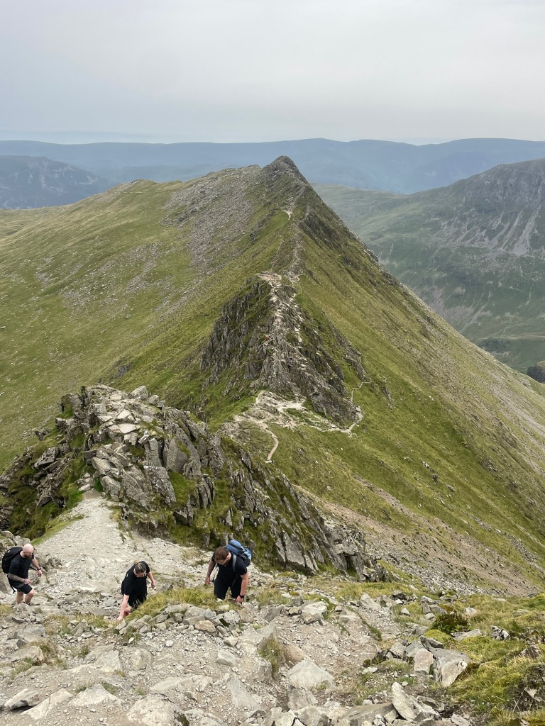
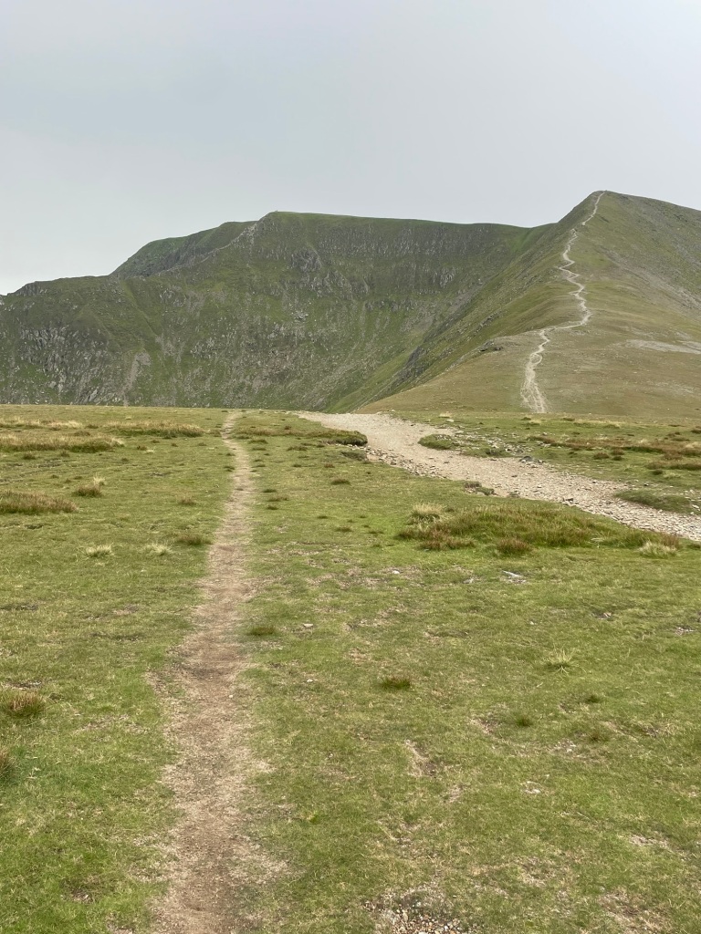
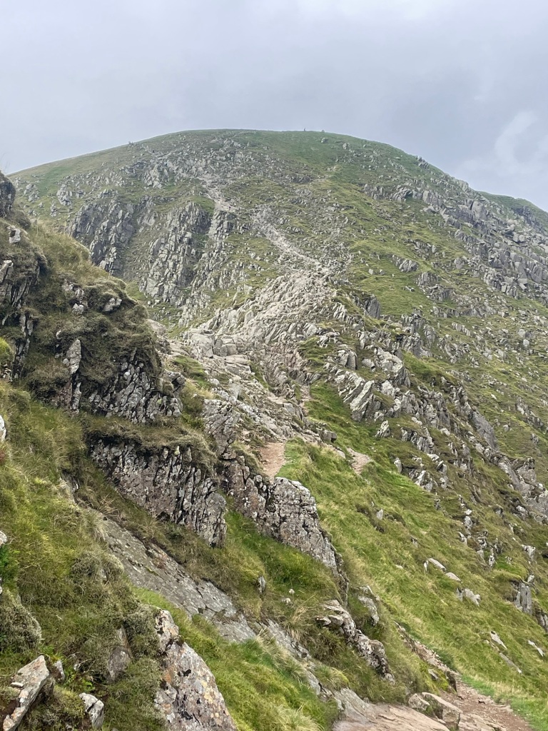
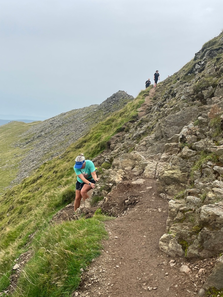
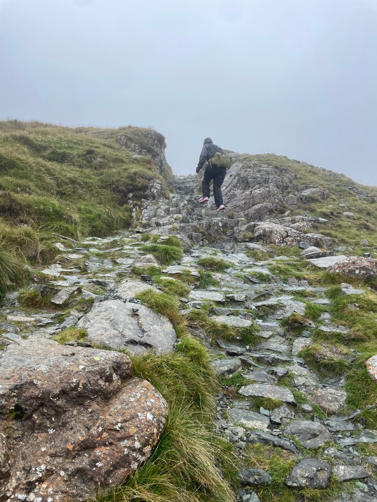
Day 12: Off to Threlkeld. Okay yah this is not a normal segment of the C2C. Since this was the Mrs first trip to the Lakes the original plan was to walk North from Helvellyn and spend a few days exploring. After about a mile from town there are three options to choose from for heading to Grasmere. The Southern route heads uphill at Thornhow End, and goes up and over St Sunday Crag, the middle route stays down in the valley along Grisedale Beck through Grisedale Forest, and then climbs up to Grisedale Tarn, and the Northern route is a steady slog from Banklands plantation up towards Hole-in-the-Wall and follows along the ridge up the Striding Edge and then turn South from Helvellyn. All three path’s join back into a single route at Grisedale Tarn before heading South through House Gap and follow the Tongue Gill into Grasmere. The Striding Edge is one of the more popular Class 1 scrambles in the UK, so do expect to experience it with a cast of others. The profile is approximately 3 miles to cover ~2450 feet of elevation gain, and because it’s a scramble it took us about 2-3 hours to reach the summit of Helvellyn. So we opted for the Striding Edge route for the challenge, which was a fair bit of fun. You can make the ascent as easy or as hard as you want with exposure, but do keep your head about you. After enjoying our lunch we continued North and followed a route that took us over Whiteside, Raise, Stybarrow Dodd, Watson’s Dodd, Great Dodd, Caifhow Pike and Clough Head before dropping down into Hauswell Brow and making our way across the valley to Threlkeld.
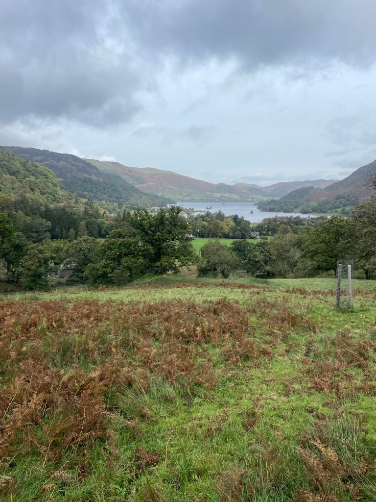
After this we ended up taking a week to explore the Lakes basing out of Cockermouth, Keswick and Ambleside. We explored Buttermere for a day and hiked around the Buttermere lake and from Ambleside we walked out to the New Dungeon Ghyll at Kirk How by way of Loughrigg Fell. After a week we headed to Grasmere (we were supposed to walk from New Dungeon Ghyll to the Travelers Rest, but uh I made a mistake in my booking so no dice..we ended up taking a bus and snagging a night in Grasmere instead).
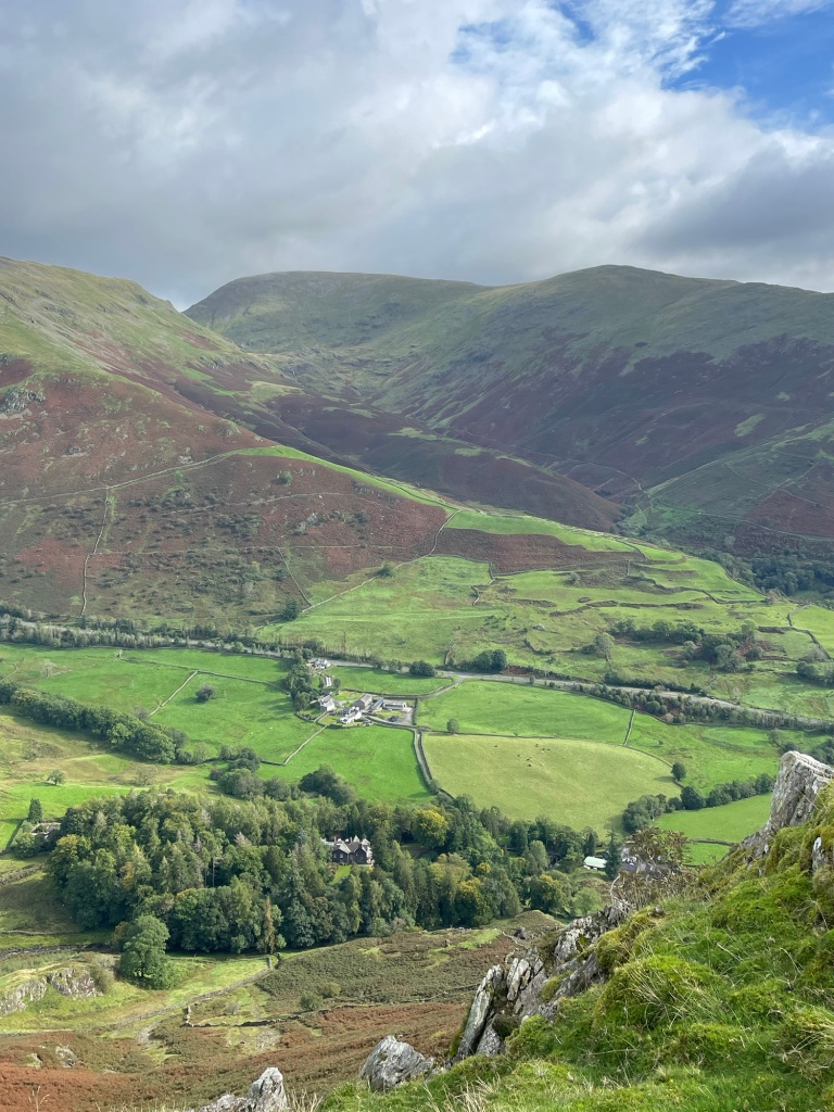
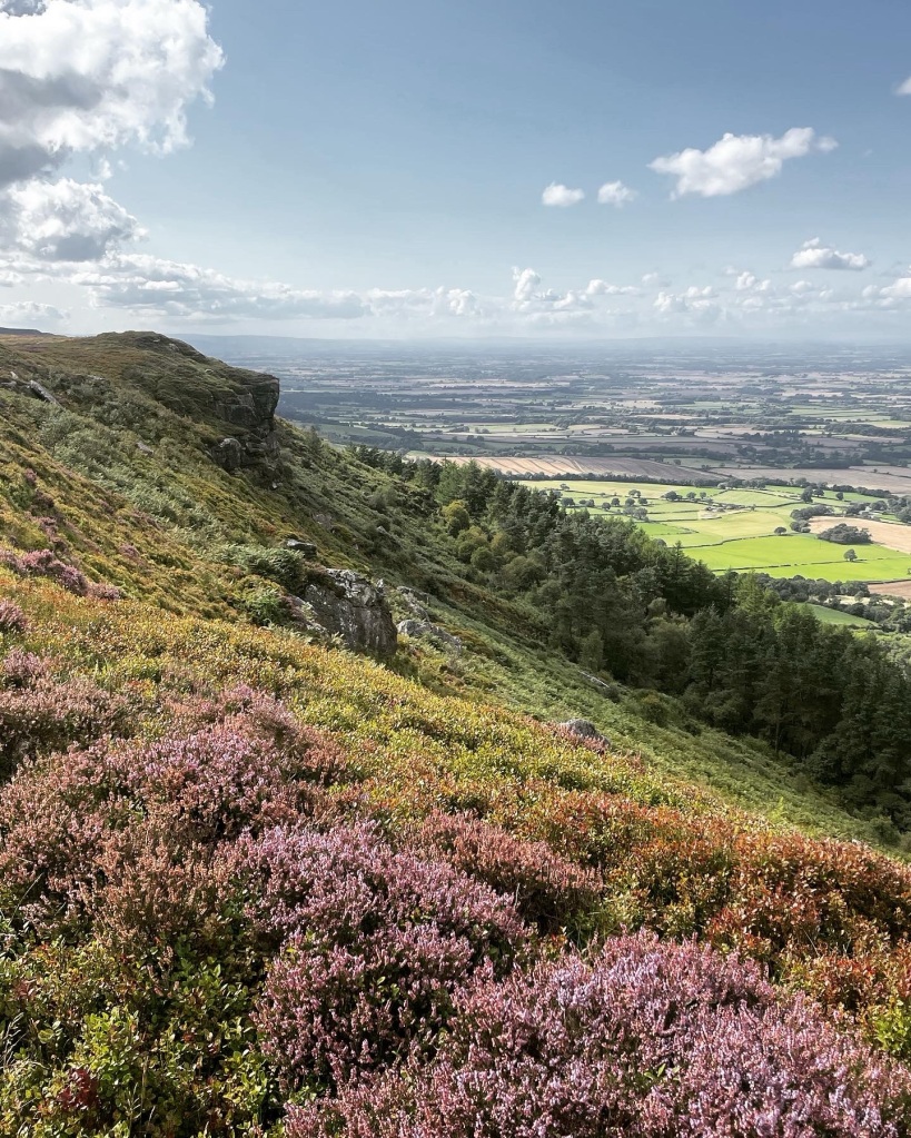
Day 18: Back to the Coast to Coast crossing from Grasmere to Borrowdale. Another day with fun route options. We again chose the high route which goes from the Traveller’s Rest Inn in Grasmere, up Jackdaw Crag and over Helm Crag, the image to the right as is the video of Super Typhoons below is from Helm Crag. The high route meets up with the lower C2C route near Mere Beck in a spaghetti mess of trails. The goal is to continue W up towards Greenup Edge. If you have never been to the Lakes, understand that the RAF loves to use those canyons for mountain air warfare training. We spent a lot of time just trying to capture any amount of video of the various planes we saw flying around. I did manage to capture some decent video from Helm Crag, however as we were taking a short break on Lining Crag I looked further down the canyon to see an F15 coming right at me, but below me in elevation. As this F15 (yes it was an F15, and not a Super Typhoon this time around) passed over me, it ended up banking to the right to begin his turn for the next canyon run, this guy was maybe 200 feet above me. I waved as he went zipping by. For the time we were in the canyons of the lake we saw Super Typhoons, F15s, some F35s and F22’s. Apparently there were a few different country’s there training up Ukrainian pilots in the various jets they were being given. I’ve always been a fighter aircraft nerd, and have had some very interesting encounters with various military aircraft while in the mountains. Borrowdale is down in a remote valley of the Lakes, with not a lot of activity, so a nice and quiet night.
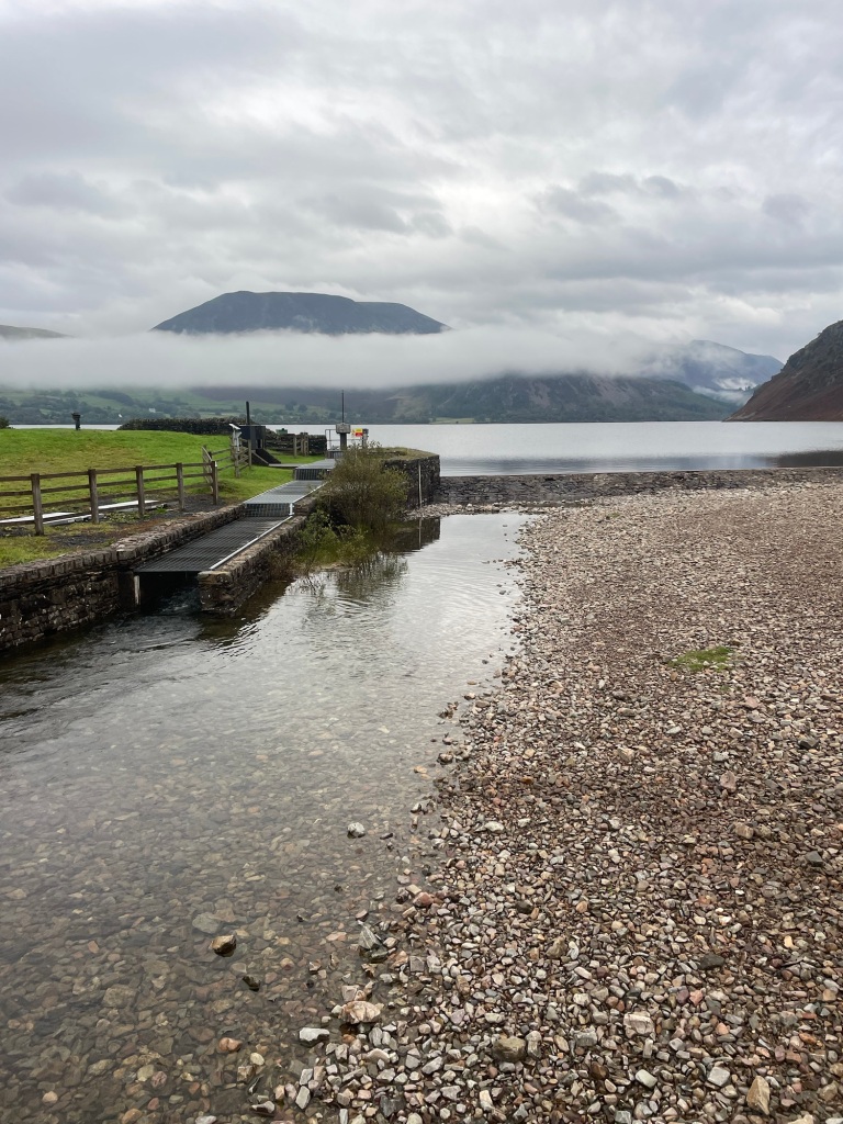
Day 19: This day probably represents why I chose to walk East to West, the reverse of this leg is day 2 of the C2C, and if you are not ready for a walk like this, the climb coming out of YHA Black Sail could be discouraging, especially if you are having a bit of the English Weather mixed in, which we did. The walk up to Honister Pass was quite easy and enjoyable, and it was warm enough that I just walked up in the rain in trail running clothes. I have a hard time not sweating out in Gore Tex, so if I am going to be wet, just get wet without the non breathable jacket on. Regardless of which direction you come a snack at Honister Slate Mine and Climbing center is worth it. After Honister Pass the path continues along the hills before a big descent down into the Scarth Beck. I will also note that a high route exists that takes you over Hay Stacks, High Crag, High Stiles, and Red Pike before descending to the YHA Ennerdale/Low Gillerthwaite Field House. We continued along the South side of Ennerdale Water before joining with some pavement for those few miles into Ennerdale Bridge. I will take this opportunity to call out the quiet BnB we booked here. We stayed at D Bradley, which there is no website, it’s not on AirBnB or Expedia or booking etc. I just noticed it on GoogleMaps a mile S of Ennerdale Bridge. I reached out and got lucky with a room. It cost £100 for the night with breakfast offered (which is pretty par for the course for all the places we stayed on this walk).
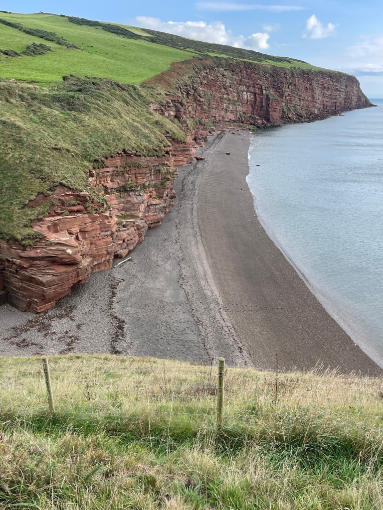
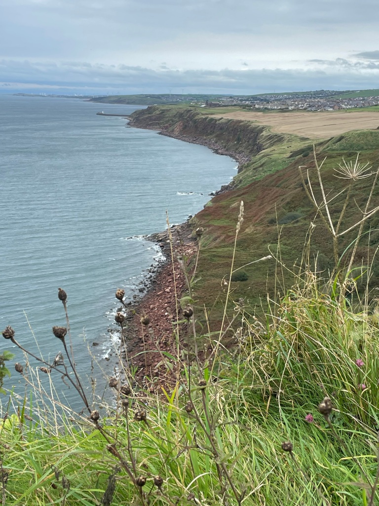
Last Day (sort of): Today we make it to the coast, turn South and walk to the starting finishing point at St Bee’s UK, where we are going to hang out for a couple of days. This segment is outside the Lake District and I would equate this to another “over the hill and through the woods”, however Grandma’s house is a big sea cliff that you walk along. Coming out of D Bradley, the high point of the day is hit pretty quickly on Dent, not really a Wainwright at 352M tall. After Dent, descend through Old Wood into Black How. From here it’s a good bit of paved walking through Cleator and Moor Row. Shortly after the town of Sandwith you reach the sea cliff, turn South for the last five miles of the walk. From the sea cliff, on clear days you can see Isle of Man. Which coming into St Bee’s we had some great weather and could make it out.
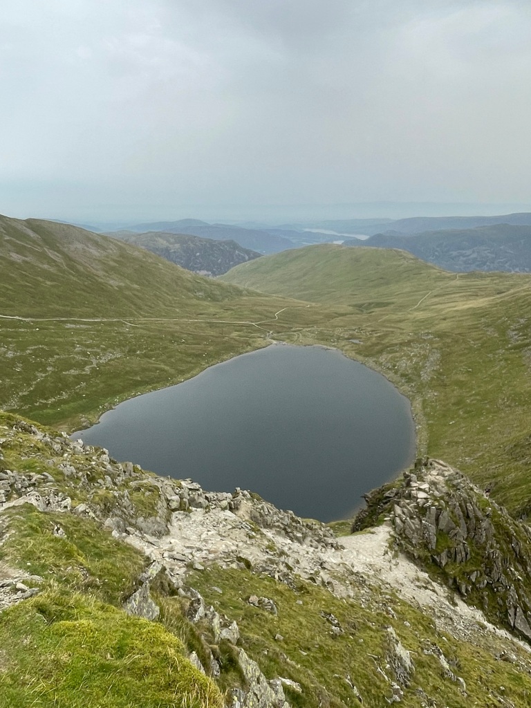
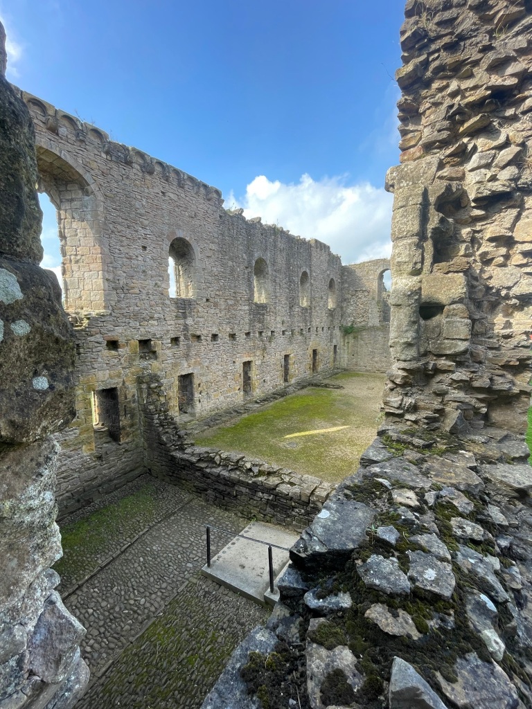
Looping back and filling in that hole: But wait, there is more. I really hated that there was an 18 mile gap in this walk that would prevent me from saying “yah I walked it”. So after a house-sit in Pittenweem Scotland we worked our way back down to Windermere to leave some extra stuff. This time I packed my Summits on the Air kit with me and we headed back to Shap. Somewhere in there we also took a side trip down to Kendall to visit the Kendal Mint Cake factory. Yah that was worth it, what we paid direct at the factory would barely buy you three mint cakes at Cotswolds or any of the other outfitters, so uh, if you like Kendal Mint Cake and are planning a long walk take the side trip through Kendal. It was now a couple weeks later in the beginning of October and the weather decided it had given us enough sunny days. We were going to knock out this 17 miles in the cool rainy foggy weather I had read about, but had only experienced in Scotland so far. Coming out of Shap we first encountered the Shap Abbey. The entrance tower mostly remains intact, but there are still lots of stone pillar footings, and stone floors remain. The English Heritage has done a good job with recreating the history of the place. After a little time here wandering around reading about the history it was time to move on towards the hills of the Lakes. There is a nice walk along the Haweswater reservoir, which if you were coming from the West is a nice recovery after coming up and over Kidsty Pike. Turn N and head UP the Kidsty Howes, which was a raging river of a trail by the time we got there and we worked our way up to the ridge and enjoyed the gentler slope to the high point. After a quick break at the Pike we proceeded onwards towards Patterdale. The walk from here is a pretty gentle down slope that goes a few miles all the way to Patterdale with views out over Ullswater and into the valley below. The next day I wanted to do some Summits on the Air, and St Sunday Crag was calling my name, so once again I walked from Patterdale to Grasemere. Since I have already been on Helvellyn twice now I wanted to take that Southern high route. The MWIS had reported that it was supposed to be another wet day, but I somehow managed to sneak a great weather window for the whole day. I could see bad weather all around me, but I just managed to walk with the sun peaking through a hole in the sky on and around me all day. There was some sort of Lakes District running event going on, so the hills were alive with lots of runners. Thanks to all the rain the segment from Grisedale Tarn to Grasmere was flowing pretty good, and a couple of times alternate routes had to be found where the trail crosses the Gill. Once in Grasemere I grabbed the bus to Windermere for Dinner with the rest of my radio buddies who all had been wet in their walks.
That is what is nice though, Wainwright did say it’s worth it to make the walk your own, or as we yanks like to say “Hike your own Hike” (man I hate that phrase). So if you have come along this trip report as part of your planning then I hope you enjoy your walk. If you are just here to read a trip report, thanks for the time! There are a couple more segments with pictures below.
Remember how I said “A plan just gets you to the trailhead?” Well fortunately we had the flexibility to change things up as needed and were not on a time crunch, but the key to any kind of long walking is to have some flexibility, and make it your own.
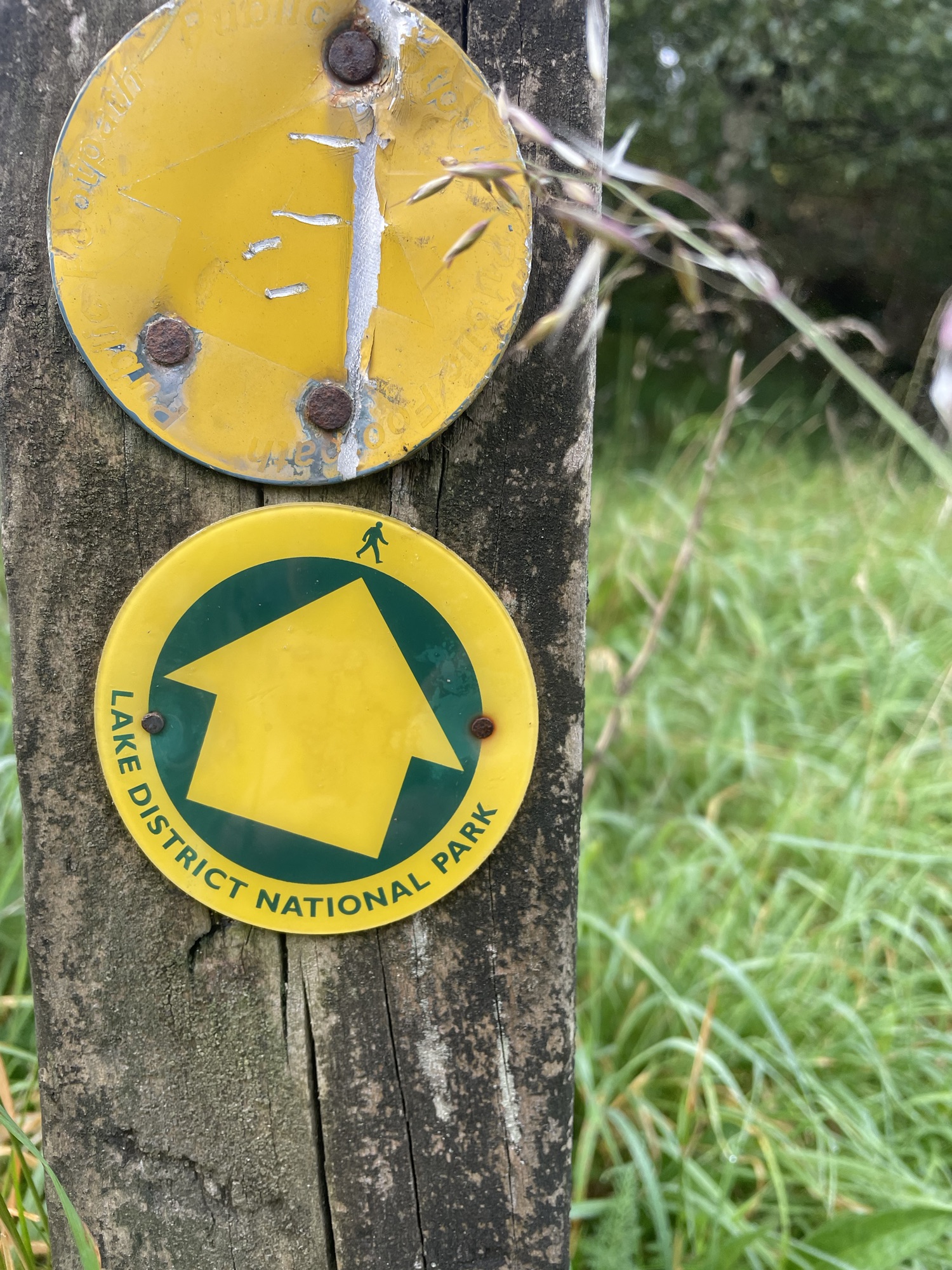
For those that do not know I love taking snaps of the trail markers/signs I encounter along the way, here is a gallery of the many that are on this walk.
Over the next few months I will be rebranding this site more inline with my other social media presences. Summits on the Air was a lot of fun and got me out to some very cool places, and really helped me further hone my planning and logistics skill sets, but the qsos do not have the magic for me they once did. Crazy too if you think about the fact the solar cycle is finally starting to heat up again. My last few activations only slightly moved me, and the desire to just walk is pulling pretty strongly for me now. I will be following up post rebrand with a write up of my recent Coast to Coast UK walk as it was a lot of fun. I may get out and do more SOtA, I have a house sit in Switzerland in about a month so I will reassess how and where SOTA may continue to play a part in my outdoor adventuring.
73 for now. de N6JFD/P
The last eight months were filled with a lot of travel, a few continents, 1 new state for me, and some time South of the equator. That said it is now time to head back to work for the summer! Earlier in the year I had planned to make this year a collection of a lot of new unique peaks as well as picking up some completes from chases and S2S over the years. Although the huge winter and me ditching most of my snow/winter worthy gear is keeping me to lower levels and easier more familiar peaks like NS-248, TR-027 etc. That said I do have some backpacking and road trips planned both North of Hwy 80, and up into the Whites. For thsoe that have never looked at the W6 map, definitely check out White Mountain road. With a few days and some full batteries for your kit there are approximately ten summits within an hour walk of White Mountain Road (most are shorter than that).
So most of my summer will be spent on Donner Summit which has my second favorite view (the view from Rainbow Bridge over Donner Lake), and the good news is I have a lot of untapped peaks up there to go after that well I just avoided for years of living in South Lake Tahoe.
TTFN, next up is me just babbling about some mindfulness practices I have used for years, but are at least worth writing about 😀
73 de N6JFD
A quick blurb about playing radio in the evening in New Zealand, and making contacts to Europe.
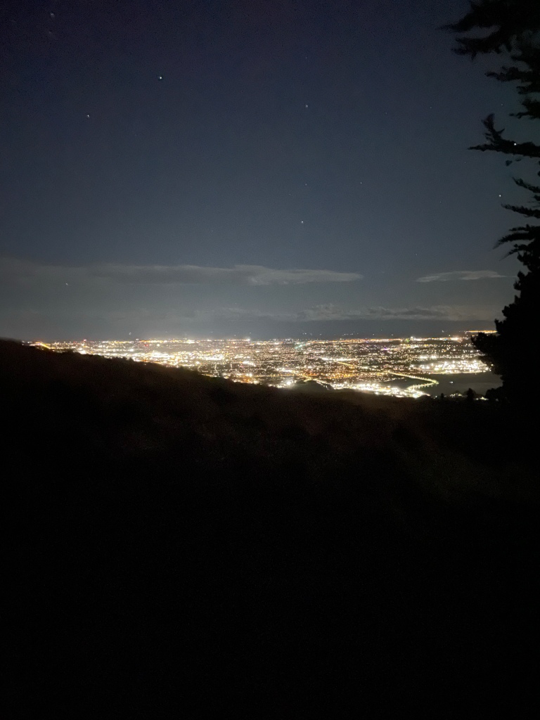
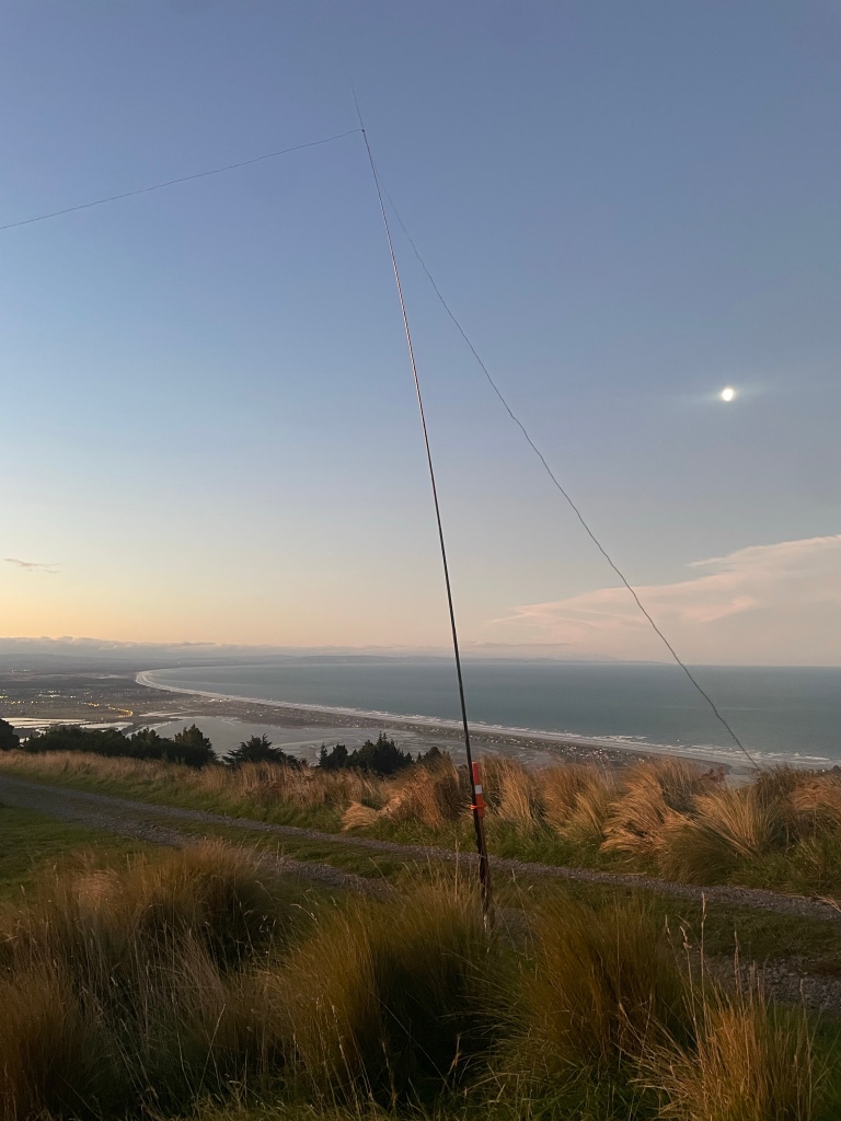
I love it when a plan comes together, however it is much more satisfying getting lucky and being in the right place at the right time. One of those days I just happened to check the reflector I noticed a posting about the JA/VK/NZ/EU S2S party scheduled for 1, April, and we just happened to be in New Zealand to boot. So far this trip, SOTA had been somewhat frustrating, there are only about 10 CW chasers total between AU and NZ, and the sun was acting like a prima donna being all kinds of super active. To the point I should have been able to see the Aurora Australis when we were in Queenstown, NZ except that it decided to cloud over and rain that night. Also to boot, for some silly reason that escapes me I decided to leave my QCX Mini (18mhz edition) at home, so all I had with me was the MTR3. 3 bands, CW only and NONE of those bands were having it during daylight hours. That said while we had been traveling, I had taken it upon myself to do a couple of night activations, and those were where I made the bulk of my DX and had some fun activations. One on Mt Kaputar (VK2/NW-001), and Mt John (ZL3/CB-625).
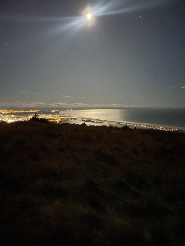
I also just happened to be staying at a friends house in Christchurch who lived a 30 minute walk from the AZ of Mt Pleasant (ZL3/CB-822), so the idea of another fun evening/sunset activation that also happened to overlook the ocean and parts of Christchurch was quite appealing. This activation ended up being my most productive activation of the 2 months down under, and I managed to work 9 different countries, all on 20M. Five contacts were actual S2S contacts, and the breakdown of DX was Germany, France, Hungary, Switzerland, Spain, Australia, Czech Republic, Greece, and Italy. I operated for about 2 hours, and enjoyed the views to be had, but once QSOs dried up it was time to walk down. Oddly enough, no JA stations on this activation, despite the couple of times I managed JA in VK land.
Some parting shots.
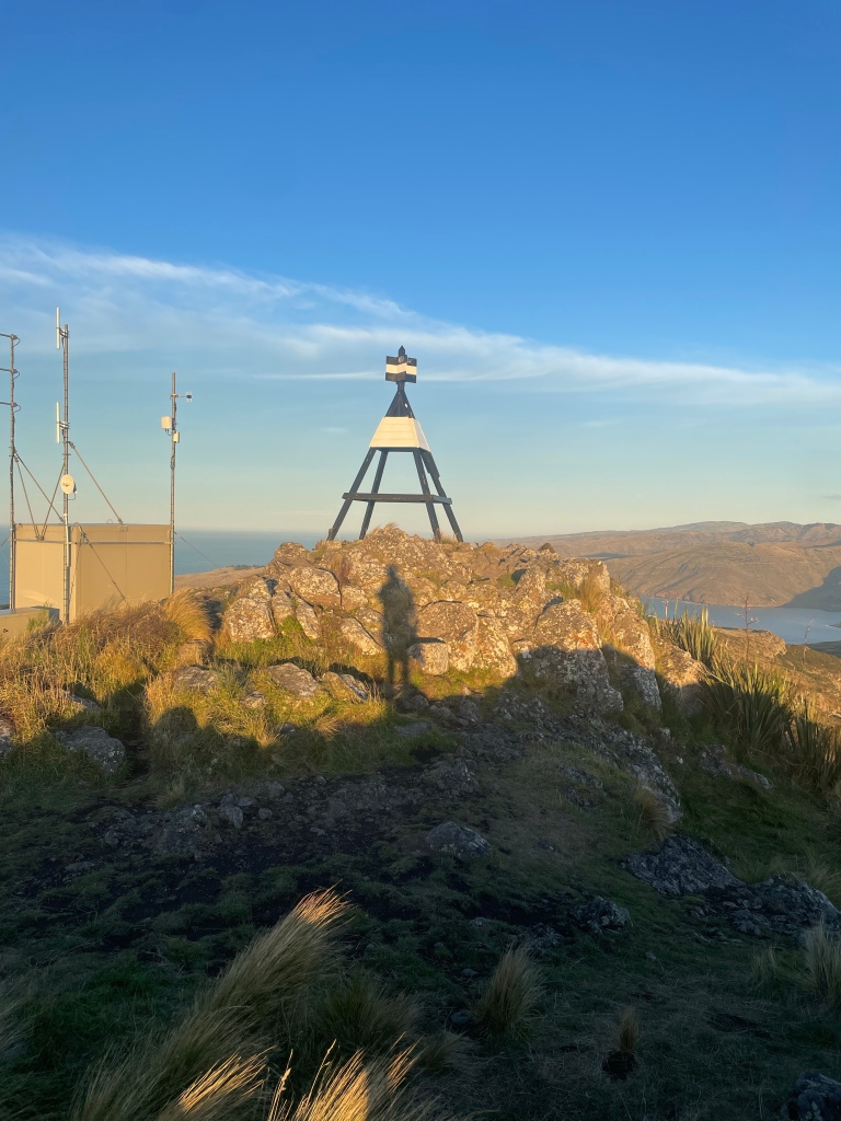
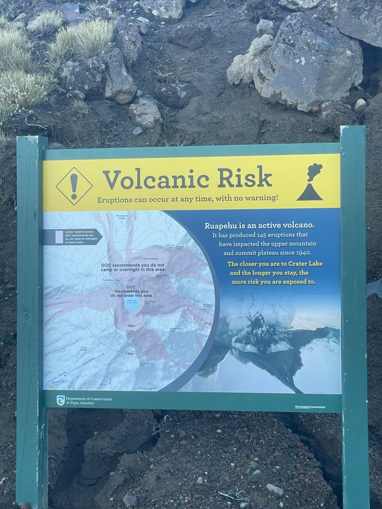
Taking a break from a long road trip to highlight one specific activation. For those not in the know we have been on the road in Au/Nz for 6 weeks now and the trip is winding down with a couple of weeks on the South Island starting later this week. However today I rolled the dice with the weather and decided to head up the North Island High Point. Mt Ruapehu is the proper name for the entire volcano, but the summit block that claims the HP is named Tahurangi. ZL1/MW-001.
This peak has only been activated once, and given some of the other issues I have been having getting contacts (that will be explained in a full write up ar a later date), I was a bit worried about getting this successfully activated on a Monday. Geoff/ZL3GA helped hook me up though with getting the word out to some of the other local cw chasers!
It was also hard finding good approach data for this peak, so well lets just roll the dice and see how we fare!
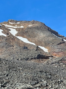
Most write ups did talk about walking up under the ski lifts and that works well, but is not the highlight of the hike. Once at the top of the High Noon chair head to the right/Easterly. There is a creek/ice field that does need to be crossed. Today there was a decent crossing however in my mind tbis was the crux and a bit unnerving. The runout would not have been good, I did find a place further downstream to cross without ice. The next goal is to make the shoulder that runs SW to NE. Take the time to notice the amazing slab that goes from about 2500M to a cliff band around 2650M. The slab is very sticky, and I found it easy for going both up and down in a straight line. Most of the tracks I found avoid the slab, but if you are comfortable on rock its safe and fun. The next bit oh fun is a lot of switchbacks, or some mild class IV climbing, but this is the steepest part of the approach.
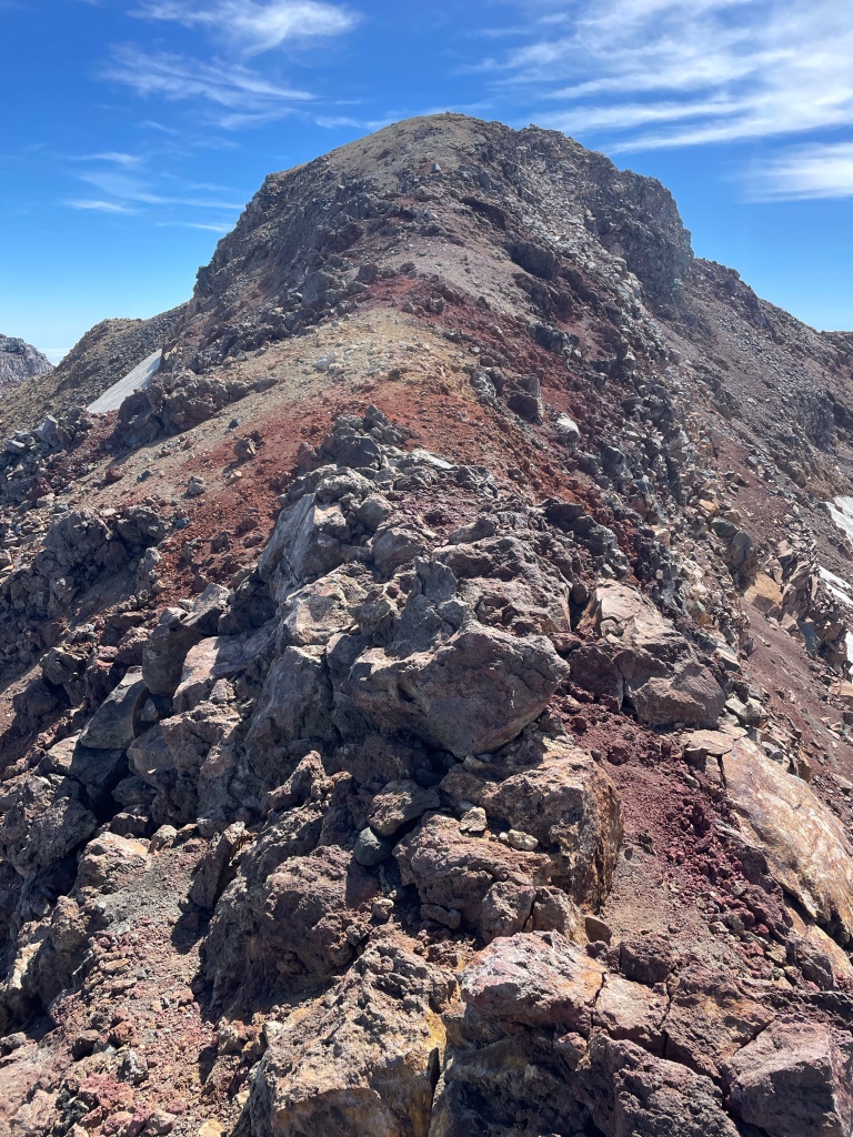
Top out on the false summit and the last 100M is pretty mellow, do note though there is about 20-25M of a spine before the shoulder gets really mild. The drop off on both sides is a bot precipitous 🙂
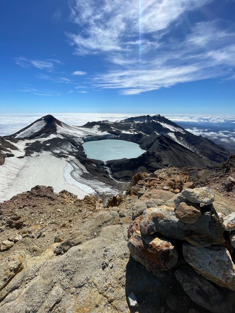
The view from up here is amazing, there is a huge lake down in the crater, a cone on the other side of the lake, and a few more summits as well. The mountain did burp a couple of times while I was up there and that was a touch unnerving, but I did not see anything spewing.
This was my best activation so far of the trip, I managed to get 9 contacts total across VHF 20/30/40M (not used to getting so few, but as noted above another story for a much bigger post).